
IMAGES TAKEN NEAR TO
Church Street, KINGSBRIDGE, TQ7 1BL
Introduction
This page details the photographs taken nearby to Church Street, TQ7 1BL by members of the Geograph project.
The Geograph project started in 2005 with the aim of publishing, organising and preserving representative images for every square kilometre of Great Britain, Ireland and the Isle of Man.

There are currently over 7.5m images from over14,400 individuals and you can help contribute to the project by visiting https://www.geograph.org.uk
Image Map
Images are licensed for reuse under creativecommons.org/licenses/by-sa/2.0
Notes
- Clicking on the map will re-center to the selected point.
- The higher the marker number, the further away the image location is from the centre of the postcode.
Image Listing (282 Images Found)
Images are licensed for reuse under creativecommons.org/licenses/by-sa/2.0
Image
Details
Distance
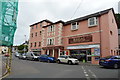
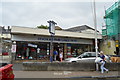
3
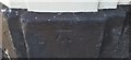
Ordnance Survey Cut Mark
This OS cut mark can be found on No7 Fore Street. It marks a point 4.110m above mean sea level.
Image: © Adrian Dust
Taken: 26 Mar 2019
0.04 miles
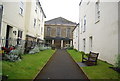
5
![Kingsbridge buildings [79]](https://s1.geograph.org.uk/geophotos/07/57/79/7577921_ec0642c2_120x120.jpg)
Kingsbridge buildings [79]
Number 4 Ebrington Street is shop with accommodation above. Built in the 18th century with a rounded corner. Constructed of rendered stone with the upper floor partly hung slate, all under a slate roof. Listed, grade II, with details at: https://historicengland.org.uk/listing/the-list/list-entry/1107516
Kingsbridge is a market town in the South Hams district of Devon. It is located at the head of an estuary some 17 miles southwest of Torquay and about 17 miles southeast of Plymouth. The town formed around a bridge built in or before the 10th century between two royal estates, giving it the name of Kyngysbrygge ("King's bridge"). Situated in the South Devon Area of Outstanding Natural Beauty and close to the South Devon coast, the town is a popular tourist destination.
Image: © Michael Dibb
Taken: 27 Jun 2023
0.04 miles
6
![Kingsbridge buildings [70]](https://s2.geograph.org.uk/geophotos/07/57/68/7576858_2944ed4e_120x120.jpg)
Kingsbridge buildings [70]
The King of Prussia public house, number 5 Church Street, was built in the early 19th century with later alterations. Constructed of stuccoed stone with hung slate to the 1st floor, under a slate roof. Listed, grade II, with details at: https://historicengland.org.uk/listing/the-list/list-entry/1107552
Kingsbridge is a market town in the South Hams district of Devon. It is located at the head of an estuary some 17 miles southwest of Torquay and about 17 miles southeast of Plymouth. The town formed around a bridge built in or before the 10th century between two royal estates, giving it the name of Kyngysbrygge ("King's bridge"). Situated in the South Devon Area of Outstanding Natural Beauty and close to the South Devon coast, the town is a popular tourist destination.
Image: © Michael Dibb
Taken: 26 Jun 2023
0.04 miles
7
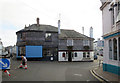
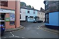
Church Street ends
To the left Ebrington Street and to the right Bridge Street.
Image: © Stuart Logan
Taken: 4 Oct 2013
0.04 miles
9
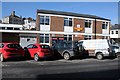
Post Office in Kingsbridge
The Post Office on Bridge Street in Kingsbridge.
Image: © Philip Halling
Taken: 16 Feb 2014
0.04 miles
