
IMAGES TAKEN NEAR TO
Vavasours Slip, DARTMOUTH, TQ6 9TR
Introduction
This page details the photographs taken nearby to Vavasours Slip, TQ6 9TR by members of the Geograph project.
The Geograph project started in 2005 with the aim of publishing, organising and preserving representative images for every square kilometre of Great Britain, Ireland and the Isle of Man.

There are currently over 7.5m images from over14,400 individuals and you can help contribute to the project by visiting https://www.geograph.org.uk
Image Map
Images are licensed for reuse under creativecommons.org/licenses/by-sa/2.0
Notes
- Clicking on the map will re-center to the selected point.
- The higher the marker number, the further away the image location is from the centre of the postcode.
Image Listing (752 Images Found)
Images are licensed for reuse under creativecommons.org/licenses/by-sa/2.0
Image
Details
Distance
1
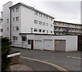
Clarence Street electricity substation, Dartmouth
The identifier on the grey door is South Western Electricity CLARENCE STREET 09-1887.
A small green label next to the identifier states that the substation has been cleaned and has had weedkiller applied by A.F.Brown & Sons.
Image: © Jaggery
Taken: 5 Jul 2014
0.01 miles
2
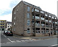
Vavasour House, Dartmouth
4-storey block of flats on the corner of North Embankment and Vavasours Slip.
Image: © Jaggery
Taken: 5 Jul 2014
0.01 miles
3
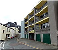
Dartside Court, Dartmouth
Holiday apartments in Clarence Street.
Image: © Jaggery
Taken: 5 Jul 2014
0.02 miles
4
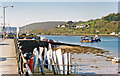
Dartmouth Harbour, 1995
View northward up the River Dart on the Rue de Courseulles du Mer (after the French port twinned with Dartmouth) extension of the North Embankment, showing the Higher Dart Ferry crossing to connect with the A379 on the east (Noss Point, Kingswear) side. The tall white objects in the middle foreground are probably upturned dinghies, used to reach the moored yachts.
Image: © Ben Brooksbank
Taken: 21 Apr 1995
0.02 miles
5
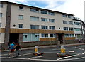
Mayflower Court, Dartmouth
Holiday apartments viewed across North Embankment. The connection between Mayflower and Dartmouth is that the Pilgrim Fathers put in to Dartmouth's Bayard's Cove in 1620, on their journey from Southampton to America. Their ships were the Mayflower and the Speedwell, but only the Mayflower completed the crossing to Cape Cod because the Speedwell was found to be unseaworthy. Dartmouth's sister town is Dartmouth, Massachusetts.
Image: © Jaggery
Taken: 5 Jul 2014
0.02 miles
6
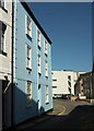
Houses on Clarence Street, Dartmouth
Glimpsed on the immediate left is The Captain's House https://historicengland.org.uk/listing/the-list/list-entry/1197549 . The blue house is not listed.
Image: © Derek Harper
Taken: 13 Sep 2020
0.02 miles
7
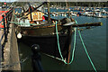
Honestas at Dartmouth
"Musselburgh is known as "The Honest Toun" ... The town motto "Honestas" dates back to 1332" https://en.wikipedia.org/wiki/Musselburgh ; Musselburgh is where her owners were based when she was launched in February 1960 https://www.nationalhistoricships.org.uk/register/2391/mfv-honestas . " Built by Herd and MacKenzie of Buckie ... As of June 2018, the vessel is currently moored at Dartmouth, in private ownership and undergoing a refit prior to being used for pleasure cruising".
Image: © Derek Harper
Taken: 27 Sep 2020
0.02 miles
8
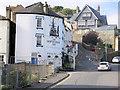
Ship in Dock Inn
The pub was built in 1871 on the site of a house dating from 1656 and is now Grade II listed with English Heritage Building ID: 387319.
Image: © Stuart Logan
Taken: 8 Oct 2013
0.03 miles
9
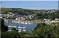
Dartmouth from Hoodown (2)
Like Image, taken from Kingswear Footpath 30 but from much further north. Right of centre is Coronation Park; left of the flats on North Embankment, trees mark Royal Avenue Gardens. Townstal climbs the valley behind.
Image: © Derek Harper
Taken: 21 Jun 2009
0.03 miles
10
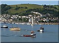
The Dart at Dartmouth
A view looking diagonally downstream and across the river from Britannia Crossing. It's a fairly quiet Sunday morning on the river, but the water taxis are usually busy.
Image: © Derek Harper
Taken: 21 Jun 2009
0.03 miles