IMAGES TAKEN NEAR TO
Jawbones Hill, DARTMOUTH, TQ6 9RN

Introduction

This page details the photographs taken nearby to Jawbones Hill, TQ6 9RN by members of the Geograph project.

The Geograph project started in 2005 with the aim of publishing, organising and preserving representative images for every square kilometre of Great Britain, Ireland and the Isle of Man.

There are currently over 7.5m images from over14,400 individuals and you can help contribute to the project by visiting https://www.geograph.org.uk

Image Map


Images are licensed for reuse under creativecommons.org/licenses/by-sa/2.0
Notes
  • Clicking on the map will re-center to the selected point.
  • The higher the marker number, the further away the image location is from the centre of the postcode.

Image Listing (934 Images Found)

Images are licensed for reuse under creativecommons.org/licenses/by-sa/2.0
  • ...
Image
Details
Distance
1
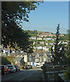
Houses, Jawbones Hill. Dartmouth
With a view over the town and the naval college.
Image: © Derek Harper Taken: 4 Aug 2021
0.01 miles
2
Smile! You're on camera
Odd name for a house.
Image: © Derek Harper Taken: 4 Aug 2021
0.03 miles
3
Jawbones Hill, Dartmouth
Dropping to the T junction with Crowther's Hill. Above the rows of houses in the background is the Royal Naval College.
Image: © Derek Harper Taken: 13 Sep 2020
0.05 miles
4
Houses on Crowther's Hill, Dartmouth
Attractive cottages at the top of the hill by the junction of Jawbones Hill and Waterpool Road.
Image: © Derek Harper Taken: 13 Sep 2020
0.05 miles
5
Ordnance Survey Cut Mark
This OS cut mark can be found on the wall SE side of Waterpool Road. It marks a point 48.384m above mean sea level.
Image: © Adrian Dust Taken: 28 Mar 2019
0.05 miles
6
Dartmouth: postbox № TQ6 161, Above Town
Looking north along Above Town, past this Victorian postbox which is emptied finally at 5:15pm on weekdays and at 11:45am on Saturdays.
Image: © Chris Downer Taken: 27 Aug 2009
0.05 miles
7
Crowther's Hill, Dartmouth
The road drops steeply into the centre of town.
Image: © Derek Harper Taken: 4 Aug 2021
0.05 miles
8
Dartmouth: Above Town
The street name is rather self-explanatory.
Image: © Chris Downer Taken: 27 Aug 2009
0.05 miles
9
Crowther's Hill
Looking up Crowther's Hill from Above Town.
Image: © S J Dowden Taken: 26 Apr 2015
0.06 miles
10
Dartmouth: bunting on Crowther?s Hill
This higher part of Crowther's Hill, west of the junction with Above Town, is indicated by road sign as having a gradient of 1 in 3, bearing out the map symbol of two arrows meaning '1 in 5 or steeper'.
Image: © Chris Downer Taken: 27 Aug 2009
0.06 miles
  • ...