
IMAGES TAKEN NEAR TO
Coombe Close, DARTMOUTH, TQ6 9PD
Introduction
This page details the photographs taken nearby to Coombe Close, TQ6 9PD by members of the Geograph project.
The Geograph project started in 2005 with the aim of publishing, organising and preserving representative images for every square kilometre of Great Britain, Ireland and the Isle of Man.

There are currently over 7.5m images from over14,400 individuals and you can help contribute to the project by visiting https://www.geograph.org.uk
Image Map
Images are licensed for reuse under creativecommons.org/licenses/by-sa/2.0
Notes
- Clicking on the map will re-center to the selected point.
- The higher the marker number, the further away the image location is from the centre of the postcode.
Image Listing (789 Images Found)
Images are licensed for reuse under creativecommons.org/licenses/by-sa/2.0
Image
Details
Distance
1
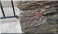
Ordnance Survey Cut Mark
This OS cut mark can be found on the Old Lodge, Clarence Hill. It marks a point 16.197m above mean sea level.
Image: © Adrian Dust
Taken: 28 Mar 2019
0.03 miles
3

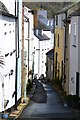
Ordnance Survey Cut Mark
This OS cut mark can be found on the gatepost north side of Ridge Hill. It marks a point 36.201m above mean sea level.
Image: © Adrian Dust
Taken: 28 Mar 2019
0.03 miles
4
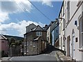
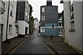
The bottom of Clarence Hill
Taken from Clarence Street with Broadstone to the left and Clarence Hill to the right.
Image: © Robin Drayton
Taken: 26 Apr 2010
0.04 miles
5
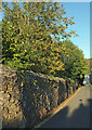
Wall, Ridge Hill, Dartmouth
Its stonework catching the afternoon sunshine.
Image: © Derek Harper
Taken: 27 Sep 2020
0.04 miles
6
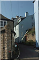
Clarence Hill, Dartmouth
From the junction with Clarence Street and Broadstone (left). Image] looks at the junction from a different angle.
Image: © Derek Harper
Taken: 13 Sep 2020
0.04 miles
8
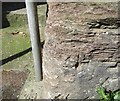
Ordnance Survey Cut Mark
This OS cut mark can be found on the wall north side of Broadstone at the foot of the steps. It marks a point 4.194m above mean sea level.
Image: © Adrian Dust
Taken: 28 Mar 2019
0.04 miles
9
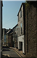
Broadstone, Dartmouth
At the junction with Zion Place (left).
Image: © Derek Harper
Taken: 13 Sep 2020
0.04 miles
10
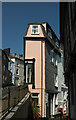
Undercliff, Dartmouth
Bringing Image] up to date.
Image: © Derek Harper
Taken: 4 Aug 2021
0.05 miles