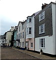
IMAGES TAKEN NEAR TO
Bayards Cove, DARTMOUTH, TQ6 9AT

Introduction

This page details the photographs taken nearby to Bayards Cove, TQ6 9AT by members of the Geograph project.

The Geograph project started in 2005 with the aim of publishing, organising and preserving representative images for every square kilometre of Great Britain, Ireland and the Isle of Man.

There are currently over 7.5m images from over14,400 individuals and you can help contribute to the project by visiting https://www.geograph.org.uk

Image Map


Images are licensed for reuse under creativecommons.org/licenses/by-sa/2.0
Notes
  • Clicking on the map will re-center to the selected point.
  • The higher the marker number, the further away the image location is from the centre of the postcode.

Image Listing (1026 Images Found)

Images are licensed for reuse under creativecommons.org/licenses/by-sa/2.0
  • ...
Image
Details
Distance
1
Bayard's Cove in Dartmouth
Scanned from a colour slide. The Pilgrim Fathers put in to this quay in Dartmouth before their departure from Plymouth
Image: © David Smith Taken: Unknown
0.00 miles
2
Dartmouth from the lower ferry
Image: © N Chadwick Taken: 2 Jun 2012
0.00 miles
3
Harbour front in Dartmouth
Houses overlooking Dartmouth harbour viewed from the car ferry between Dartmouth and Kingswear.
Image: © Philip Halling Taken: 9 Jun 2011
0.01 miles
4
Plaque to Humphrey Gilbert
A blue plaque on the wall of a building on Bayard's Cove, Dartmouth. For a biography see http://www.elizabethan-era.org.uk/sir-humphrey-gilbert.htm
Image: © Stephen Craven Taken: 26 Sep 2010
0.01 miles
5
Bayard's Cove, Dartmouth
Dartmouth's original wharf, a relatively small area protected by a fort at the southern end of the town. The Pilgrim Fathers put in to Bayard's Cove on their journey from Southampton to America. The setting has been used in many television productions, most notably as a Liverpool quay for "The Onedin Line" a popular BBC television drama series of the 1970s.
Image: © Peter Tarleton Taken: 17 Jun 2012
0.01 miles
6
Boat on Bayard's Cove
At high water springs the sea level rises above the coping on Bayard's Cove. This is just after high water and the residual water left by the tide can clearly be seen on the surface of the quay. Bayard's Cove was the final departure point of the Mayflower and the Speedwell, who had been blown East after leaving Plymouth and put into Dartmouth for repairs.
Image: © S J Dowden Taken: 21 Feb 2015
0.01 miles
7
Bayard's Cove, Dartmouth
The houses face the River Dart.
Image: © Jaggery Taken: 5 Jul 2014
0.01 miles
8
Bayards Cove, Dartmouth
Most of the buildings along this cobbled quay, including the lamp post, are Grade II Listed. See https://www.historicengland.org.uk/listing/the-list/list-entry/1293287
Image: © Ian Taylor Taken: Unknown
0.01 miles
9
Bayards Cove, Dartmouth
Most of the buildings along this cobbled quay, including the lamp post, are Grade II Listed. See https://www.historicengland.org.uk/listing/the-list/list-entry/1293287
Image: © Ian Taylor Taken: Unknown
0.01 miles
10
Batard's Cove, Dartmouth
Image: © Colin Park Taken: 26 Mar 1977
0.01 miles
  • ...