1
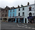
Thomas Newcomen plaque
http://www.geograph.org.uk/photo/1854373
Image: © Robin Drayton
Taken: 26 Apr 2010
0.00 miles
2
Dartmouth: notes on the Cherub Inn
A notice at the foot of the steps that lead up to
Image on Higher Street. The vandalism has resulted in the obliteration of the two points at which the year is mentioned, rather annoyingly – I guess the inference is that they are in the 1300s with the third digit either a 3 or an 8.
Image: © Chris Downer
Taken: 27 Aug 2009
0.01 miles
3
The Harbour Bookshop, Fairfax Place
The blue plaque on the building states:
"In 1951 the Harbour Bookshop was opened in this building by CHRISTOPHER MILNE (1920-1996) son of A A.Milne who portrayed him in the Christopher Robin poems and stories. In 1959, he founded the Dartmouth and Kingswear society."
Image: © Robin Drayton
Taken: 26 Apr 2010
0.01 miles
4
The Cherub, Dartmouth
Now a pub, the Cherub is at 13 Higher Street. An information board on the wall states that this is the oldest,
and sole surviving medieval, house in the ancient borough of Dartmouth, believed to have been erected as a merchant's house in about 1380. Grade II* listed in 1949.
Image: © Jaggery
Taken: 5 Jul 2014
0.01 miles
5
The Cherub on Higher Street, Dartmouth
http://www.geograph.org.uk/photo/4380449
http://www.geograph.org.uk/photo/4380465
Image: © Ian S
Taken: 8 Mar 2015
0.01 miles
6
The Cherub on Higher Street, Dartmouth
http://www.geograph.org.uk/photo/4380461
http://www.geograph.org.uk/photo/4380449
Image: © Ian S
Taken: 8 Mar 2015
0.01 miles
7
The Cherub Inn, Higher Street, Dartmouth
The building is grade II* listed (list entry 1209644) and described as a 15th century merchant's house, restored in 1957 and now a pub.
Image: © Stephen Craven
Taken: 12 Jul 2021
0.01 miles
8
Sea Haven shop in Dartmouth
Newcomen Road shop selling leisure wear, camping equipment, fishing tackle etc.
Image: © Jaggery
Taken: 5 Jul 2014
0.01 miles
9
Newcomen Road
Named after Thomas Newcomen, who developed the first practical steam engine for pumping water.
A small plaque http://www.geograph.org.uk/photo/1854359 on the wall behind the parked cars commemorates the fact that his workshop stood here.
Elsewhere in Dartmouth there is a memorial http://www.geograph.org.uk/photo/1854347 to Thomas Newcomen and an example of one of his steam engines http://www.geograph.org.uk/photo/677020 .
Image: © Robin Drayton
Taken: 26 Apr 2010
0.01 miles
10
Fairfax Place, Dartmouth
Image: © Ian S
Taken: 8 Mar 2015
0.01 miles


