
IMAGES TAKEN NEAR TO
Swannaton Road, DARTMOUTH, TQ6 0JS
Introduction
This page details the photographs taken nearby to Swannaton Road, TQ6 0JS by members of the Geograph project.
The Geograph project started in 2005 with the aim of publishing, organising and preserving representative images for every square kilometre of Great Britain, Ireland and the Isle of Man.

There are currently over 7.5m images from over14,400 individuals and you can help contribute to the project by visiting https://www.geograph.org.uk
Image Map
Images are licensed for reuse under creativecommons.org/licenses/by-sa/2.0
Notes
- Clicking on the map will re-center to the selected point.
- The higher the marker number, the further away the image location is from the centre of the postcode.
Image Listing (56 Images Found)
Images are licensed for reuse under creativecommons.org/licenses/by-sa/2.0
Image
Details
Distance
1
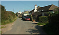
Higher Swannaton
Swannaton Road reaches the hamlet of about five properties including Higher Swannaton Farm. On the right is the start of Dartmouth Footpath 5, used by the Diamond Jubilee Way.
Image: © Derek Harper
Taken: 13 Sep 2020
0.00 miles
2
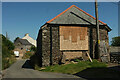
Barn, Swannaton
By Swannaton Road. On the left are the buildings seen in Image
Image: © Derek Harper
Taken: 4 Aug 2021
0.01 miles
3
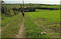
Footpath from Swannaton
The Diamond Jubilee Way follows Dartmouth Footpath 5 to Higher Week or Weeke, depending on map scale.
Image: © Derek Harper
Taken: 13 Sep 2020
0.03 miles
4
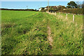
Diamond Jubilee Way approaching Swannaton
Looking up the path (Dartmouth Footpath 5) that Image] looks down.
Image: © Derek Harper
Taken: 13 Sep 2020
0.04 miles
5
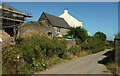
Swannaton
There is much building work under way in the little farming hamlet as restoration and repair takes place.
Image: © Derek Harper
Taken: 4 Aug 2021
0.05 miles
6
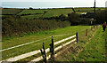
Approaching Higher Weeke
(Higher Week on the 1:25000 map). The walker is following the Diamond Jubilee Way along Dartmouth Footpath 5.
Image: © Derek Harper
Taken: 13 Sep 2020
0.07 miles
7
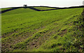
Farmland, Swannaton
Image: © Derek Harper
Taken: 13 Sep 2020
0.08 miles
8
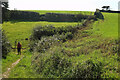
Diamond Jubilee Way at Higher Weeke
A left turn on Dartmouth Footpath 5 to go round the cottages.
Image: © Derek Harper
Taken: 13 Sep 2020
0.08 miles
9
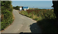
Lane, Swannaton
Swannaton Road between barns at the hamlet.
Image: © Derek Harper
Taken: 4 Aug 2021
0.09 miles
10
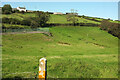
Combe below Higher Week
From the Diamond Jubilee Way. The falling ground immediately in front of the camera is the site of a disused quarry https://www.heritagegateway.org.uk/Gateway/Results_Single.aspx?uid=MDV44851&resourceID=104 . On the left is a tennis court. Up above is the farmhouse at Higher Swannaton.
Image: © Derek Harper
Taken: 13 Sep 2020
0.11 miles