
IMAGES TAKEN NEAR TO
DARTMOUTH, TQ6 0FE
Introduction
This page details the photographs taken nearby to TQ6 0FE by members of the Geograph project.
The Geograph project started in 2005 with the aim of publishing, organising and preserving representative images for every square kilometre of Great Britain, Ireland and the Isle of Man.

There are currently over 7.5m images from over14,400 individuals and you can help contribute to the project by visiting https://www.geograph.org.uk
Image Map
Images are licensed for reuse under creativecommons.org/licenses/by-sa/2.0
Notes
- Clicking on the map will re-center to the selected point.
- The higher the marker number, the further away the image location is from the centre of the postcode.
Image Listing (67 Images Found)
Images are licensed for reuse under creativecommons.org/licenses/by-sa/2.0
Image
Details
Distance
1
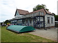
Sports pavilion Britannia Royal Naval College
Seen during an open day at the famous college for naval officer training. The building has seen better days and the end nearest the camera was fenced off for safety.
Image: © Chris Allen
Taken: 8 Jul 2017
0.05 miles
2
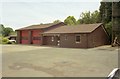
Dartmouth Fire Station
Dartmouth Fire Station, College Way, Dartmouth, Devon, near the Royal Naval College.
Image: © Kevin Hale
Taken: 13 Jul 1995
0.15 miles
3
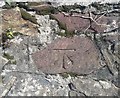
Ordnance Survey Cut Mark
This OS cut mark can be found on the wall north side of Townstal Road. It marks a point 89.870m above mean sea level.
Image: © Adrian Dust
Taken: 28 Mar 2019
0.16 miles
4
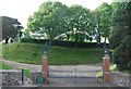
Gates, Britannia Royal Naval College
Wikipedia: http://en.wikipedia.org/wiki/Britannia_Royal_Naval_College
Image: © N Chadwick
Taken: 6 Jun 2012
0.16 miles
5
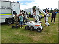
Royal Navy Bomb Disposal display
At the Britannia Royal Naval College 2017 open day. This was one of the displays on the playing fields behind the main college buildings.
Image: © Chris Allen
Taken: 8 Jul 2017
0.17 miles
6
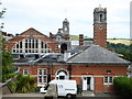
Britannia Royal Naval College
The architecture seen from one end of the main building showing the arched window illuminating the dining room. The central clock tower is seen in the background.
Image: © Chris Allen
Taken: 8 Jul 2017
0.18 miles
7
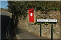
Postbox, Townstal
Victorian postbox TQ6 154 is at the crossroads of Townstal Road (left) and Mount Boone.
Image: © Derek Harper
Taken: 27 Sep 2020
0.18 miles
8

Coastguard display - Britannia Royal Naval College
On the public open day that allowed large numbers of the public to enjoy this large site. For me the highlight was the Daring bridge simulator. This was illuminated in a low red light anyway and I'm not sure the Naval instructors would have been keen on being photographed.
Image: © Chris Allen
Taken: 8 Jul 2017
0.18 miles
9
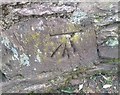
Ordnance Survey Cut Mark
This OS cut mark can be found on the outbuilding of No17 Mount Boone. It marks a point 61.585m above mean sea level.
Image: © Adrian Dust
Taken: 28 Mar 2019
0.19 miles
10

Britannia Royal Naval College - fire brigade demonstration
Public open day with family fun.
Image: © Chris Allen
Taken: 8 Jul 2017
0.19 miles