IMAGES TAKEN NEAR TO
Bolton Street, BRIXHAM, TQ5 9DW

Introduction

This page details the photographs taken nearby to Bolton Street, TQ5 9DW by members of the Geograph project.

The Geograph project started in 2005 with the aim of publishing, organising and preserving representative images for every square kilometre of Great Britain, Ireland and the Isle of Man.

There are currently over 7.5m images from over14,400 individuals and you can help contribute to the project by visiting https://www.geograph.org.uk

Image Map


Images are licensed for reuse under creativecommons.org/licenses/by-sa/2.0
Notes
  • Clicking on the map will re-center to the selected point.
  • The higher the marker number, the further away the image location is from the centre of the postcode.

Image Listing (107 Images Found)

Images are licensed for reuse under creativecommons.org/licenses/by-sa/2.0
  • ...
Image
Details
Distance
1
Brixham Fire Station
The little station was built in 1948 (a number of nearby buildings show similar architecture), but has suffered from flooding in recent years, prompting complaints from crews. Compare with Kevin Hale's pic of 1995 - Image
Image: © Neil Owen Taken: 19 Jul 2011
0.01 miles
2
Brixham Fire Station
Brixham Fire Station, Bolton Street, Brixham, Devon.
Image: © Kevin Hale Taken: 13 Jul 1995
0.01 miles
3
Salvation Army, Brixham
Occupying a limestone building on Bolton Street.
Image: © Derek Harper Taken: 12 Jun 2014
0.02 miles
4
Brixham Fire Station
Image: © David Smith Taken: 31 Aug 2012
0.02 miles
5
Windmill Hill
Looking across Bolton Street to Windmill Hill which climbs very steeply uphill.
Image: © Tony Atkin Taken: 4 Apr 2010
0.03 miles
6
Windmill Hill, Brixham
A steep descent to Bolton Street, with a view across the upper town of Brixham, known as Cowtown.
Image: © Derek Harper Taken: 23 Mar 2009
0.03 miles
7
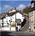
Bolton Street and Mount Pleasant Road, Brixham
Mount Pleasant Road climbs away from Bolton Street, which drops down the valley bottom towards the town centre, with a glimpse of All Saints' Church.
Image: © Derek Harper Taken: 4 Sep 2011
0.04 miles
8
Plaque, Bolton Street, Brixham
On the wall of the former Liberal Club building, and commemorating the laying of a stone in 1896, I think (the inscription has been damaged). Sir Francis Layland-Barratt was the Liberal MP for the old Torquay constituency from 1900-1910. George Soudon Bridgman had been the designer of Paignton Pier, opened in 1879. This building can be seen on the left of Image and is now divided into flats.
Image: © Derek Harper Taken: 12 Jun 2014
0.04 miles
9
'Stop and Pay'
An inscription at the junction of Rea Barn Road and Bolton Street. No other clues are given as to the quote, but there appears to have been a number of Petherbridges in the area who were involved with the church.
Image: © Neil Owen Taken: 19 Jul 2011
0.05 miles
10
Great Gate, Brixham
The junction is also shown at http://www.geograph.org.uk/search.php?i=50852812 . Rea Barn House, the building in the centre also shown in Image, is listed and described at http://list.english-heritage.org.uk/resultsingle.aspx?uid=1195116&searchtype=mapsearch .
Image: © Derek Harper Taken: 12 Jun 2014
0.05 miles
  • ...