
IMAGES TAKEN NEAR TO
Thrushel Close, BRIXHAM, TQ5 0RD
Introduction
This page details the photographs taken nearby to Thrushel Close, TQ5 0RD by members of the Geograph project.
The Geograph project started in 2005 with the aim of publishing, organising and preserving representative images for every square kilometre of Great Britain, Ireland and the Isle of Man.

There are currently over 7.5m images from over14,400 individuals and you can help contribute to the project by visiting https://www.geograph.org.uk
Image Map
Images are licensed for reuse under creativecommons.org/licenses/by-sa/2.0
Notes
- Clicking on the map will re-center to the selected point.
- The higher the marker number, the further away the image location is from the centre of the postcode.
Image Listing (5 Images Found)
Images are licensed for reuse under creativecommons.org/licenses/by-sa/2.0
Image
Details
Distance
1
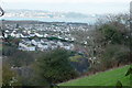
Overlooking Higher Brixham
View northeast across this grid square. Taken from the track above the Kingswear Road. Torbay in the far distance
Image: © Crispin Purdye
Taken: 15 Nov 2005
0.07 miles
2
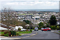
View from Kings Barton
Looking ENE from this elevated housing development. Most of Higher Brixham and Rea Hill is visible from this point with Berry Head in the centre distance.
Image: © Crispin Purdye
Taken: 16 Nov 2005
0.07 miles
3
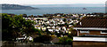
View from Kings Barton, Brixham
Looking north east from high ground above Brixham this view takes in Tor Bay with Hope's Nose and Thatcher Rock at the left. The rock, centre right is the Ore Stone. The red cliffs visible on the far horizon are near Budleigh Salterton, 18 miles distant, and Sidmouth, 24 miles, is at the extreme right horizon.
Image: © Crispin Purdye
Taken: 16 Nov 2005
0.11 miles
4
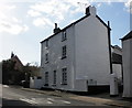
Challeycroft, Milton Street, Higher Brixham
Image: © Roger Cornfoot
Taken: 14 Mar 2010
0.23 miles
5
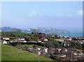
Houses beyond Guzzle Down, Torbay in distance
View across Torbay from Raddicombe Drive
Image: © Tom Jolliffe
Taken: 19 Mar 2007
0.25 miles