
IMAGES TAKEN NEAR TO
Ferrers Green, BRIXHAM, TQ5 0LF
Introduction
This page details the photographs taken nearby to Ferrers Green, TQ5 0LF by members of the Geograph project.
The Geograph project started in 2005 with the aim of publishing, organising and preserving representative images for every square kilometre of Great Britain, Ireland and the Isle of Man.

There are currently over 7.5m images from over14,400 individuals and you can help contribute to the project by visiting https://www.geograph.org.uk
Image Map
Images are licensed for reuse under creativecommons.org/licenses/by-sa/2.0
Notes
- Clicking on the map will re-center to the selected point.
- The higher the marker number, the further away the image location is from the centre of the postcode.
Image Listing (32 Images Found)
Images are licensed for reuse under creativecommons.org/licenses/by-sa/2.0
Image
Details
Distance
1
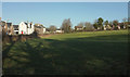
Field, Churston
On the extreme left are the estate cottages https://historicengland.org.uk/listing/the-list/list-entry/1292954 shown in Image Past the white house are four more estate cottages https://historicengland.org.uk/listing/the-list/list-entry/1298245 . The modern houses to the right are on Ferrers Green.
Image: © Derek Harper
Taken: 19 Jan 2020
0.07 miles
2
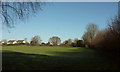
Field, Churston Ferrers
The eastern end of the field shown in Image], again with houses on Ferrers Green, from the path shown in Image
Image: © Derek Harper
Taken: 19 Jan 2020
0.10 miles
3
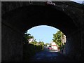
Railway Bridge, Churston Ferrers, near Brixham
At the end of this road, it is designated one way to prevent traffic from getting access to the main road into Brixham as the corner is very difficult to negotiate, the traffic flows fast and the road is narrow. It has made it much quieter for residents.
Image: © Tom Jolliffe
Taken: 3 May 2009
0.11 miles
4
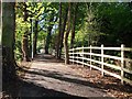
New cycle track, near Brixham
This new track enables cyclists to avoid the very busy and fast main road into Brixham, which is below on the right of this picture. Some controversy has been generated by a local landowner who offered part of a field for the track at no cost to the Council in return for planning permission. This was not accepted and the landowner has now claimed that the cost of the new track was excessive and unnecessary.
There is no doubt that this new short stretch off the road is a great improvement for cyclists and likely to encourage new ones.
Image: © Tom Jolliffe
Taken: 3 May 2009
0.11 miles
5
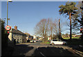
Churston Cross
Alston Lane meets the A3002 Brixham Road; on the other side is Churston Road. The pair of houses on the left are shown in Image] https://historicengland.org.uk/listing/the-list/list-entry/1195182 ; beyond is West Terrace, the row of six cottages https://historicengland.org.uk/listing/the-list/list-entry/1292954 shown in Image The John Musgrave Heritage Trail goes past.
Image: © Derek Harper
Taken: 19 Jan 2020
0.14 miles
6
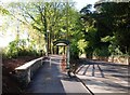
New cycle track, Brixham
This new off-road cycle path, rising up to the left in the picture, enables Brixham residents to cycle out of Brixham and back (this shows the way back) in reasonable safety. It is well landscaped, too. No traffic at 8 a.m. on a Sunday, but usually there is a constant stream of traffic travelling at speed. I see the cycle track as the route for the future - no fossil fuel used for short to medium journeys, just calories burned and health enhanced. Back to the future.
Image: © Tom Jolliffe
Taken: 3 May 2009
0.14 miles
7
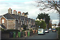
Churston Road, Churston Ferrers
Northerly view along the main residential road in this village
Image: © Crispin Purdye
Taken: 16 Nov 2005
0.14 miles
8
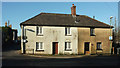
Cottages, Churston
"Pair of cottages built as a single range. Probably C18/C19 remodelling of an earlier building ... The building occupies an important corner site, relating to groups of listed buildings in both Brixham and Churston Roads. It is shown as a single house on the Churston Ferrers tithe map of 1839" https://historicengland.org.uk/listing/the-list/list-entry/1195182 . On the left is the A3022.
Image: © Derek Harper
Taken: 19 Jan 2020
0.14 miles
9
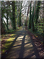
Path by the A3022
A footpath that carries you from Churston Cross to a safer crossing point on the main road by the bus stop at the north lodges for Lupton House.
Image: © Derek Harper
Taken: 19 Jan 2020
0.15 miles
10
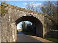
Disused railway bridge, Churston
In 2009 there was a call for a railway line to Brixham to be reopened http://news.bbc.co.uk/1/hi/england/8099912.stm , although as Image points out, there would be difficulties in using the previous route. This bridge still looks pretty solid, though.
Image: © Derek Harper
Taken: 16 Jan 2012
0.15 miles