
IMAGES TAKEN NEAR TO
Rowan Road, TQ4 7UD
Introduction
This page details the photographs taken nearby to Rowan Road, TQ4 7UD by members of the Geograph project.
The Geograph project started in 2005 with the aim of publishing, organising and preserving representative images for every square kilometre of Great Britain, Ireland and the Isle of Man.

There are currently over 7.5m images from over14,400 individuals and you can help contribute to the project by visiting https://www.geograph.org.uk
Image Map
Images are licensed for reuse under creativecommons.org/licenses/by-sa/2.0
Notes
- Clicking on the map will re-center to the selected point.
- The higher the marker number, the further away the image location is from the centre of the postcode.
Image Listing (75 Images Found)
Images are licensed for reuse under creativecommons.org/licenses/by-sa/2.0
Image
Details
Distance
1
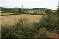
Fields near Yalberton
Between the new Fusion development and Yalberton Road, with an arrangement of electricity sub stations to the right of the pylon. In the background on the right is Primley Wood. See also Image] and Image
Image: © Derek Harper
Taken: 30 Aug 2018
0.02 miles
2
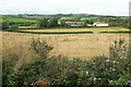
Fields near Yalberton
Looking left from where Image] was taken, with overlap. Beyond the two fields runs Yalberton Road with the Yalberton Industrial Estate behind. In the distance are the masts on Beacon Hill.
Image: © Derek Harper
Taken: 30 Aug 2018
0.05 miles
3
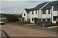
New houses on Foxgolve Way, Paignton
Currently the end of the Fusion development, with finishing touches behind put on these houses; Image] was taken from the end of the road on the left.
Image: © Derek Harper
Taken: 30 Aug 2018
0.06 miles
4
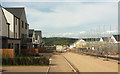
Foxglove Way, Fusion development
The current western edge of housing on this estate, with construction taking place on the right.
Image: © Derek Harper
Taken: 30 Aug 2018
0.08 miles
5

Gull on trolley park, Paignton Sainsbury's
In the car park at the Yalberton Road store.
Image: © Derek Harper
Taken: 26 Apr 2016
0.10 miles
6

Farmland near Yalberton
From where Image] was taken, looking left with overlap. In the background is Windmill Hill, its summit in Image although Langdon Plantation in the centre is in Image
Image: © Derek Harper
Taken: 30 Aug 2018
0.11 miles
7
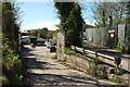
Breakers' yard, Paignton
In an former quarry, and formerly Quarry Breakers, this scrapped car depot is off Yalberton Road. On the right is the parallel entrance to the small Miglo Industrial Estate.
Image: © Derek Harper
Taken: 26 Apr 2016
0.12 miles
8
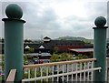
Supermarket, Brixham Road
The view of Sainsbury's supermarket from the footbridge shows it to be one of a standarized design. This was built by Plymco originally.
Image: © Tom Jolliffe
Taken: 5 May 2010
0.12 miles
9
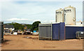
Dry mortar silos, Fusion development
On the current building site on Foxglove Way.
Image: © Derek Harper
Taken: 30 Aug 2018
0.12 miles
10

Foxglove Way, Fusion development
A reverse view of Image, with houses facing downhill across the construction site.
Image: © Derek Harper
Taken: 30 Aug 2018
0.13 miles