
IMAGES TAKEN NEAR TO
Grange Road, PAIGNTON, TQ4 7JP
Introduction
This page details the photographs taken nearby to Grange Road, TQ4 7JP by members of the Geograph project.
The Geograph project started in 2005 with the aim of publishing, organising and preserving representative images for every square kilometre of Great Britain, Ireland and the Isle of Man.

There are currently over 7.5m images from over14,400 individuals and you can help contribute to the project by visiting https://www.geograph.org.uk
Image Map
Images are licensed for reuse under creativecommons.org/licenses/by-sa/2.0
Notes
- Clicking on the map will re-center to the selected point.
- The higher the marker number, the further away the image location is from the centre of the postcode.
Image Listing (19 Images Found)
Images are licensed for reuse under creativecommons.org/licenses/by-sa/2.0
Image
Details
Distance

2

Turf zone Valley Lakes
At Clennon Valley, Torbay.
Image: © Ian S
Taken: 11 Feb 2023
0.17 miles
3

Penwill Way, view over Clennon Valley
This type of weather in the morning reminds residents why Torbay is such a popular environment for holidaymakers and residents alike. Clennon Valley has been prone to flooding in the past, there is stream at the bottom which is affected by the tidal movements. Once or twice the road at the bottom has been impassable without serious risk to car engines. This morning it is impossible to imagine such conditions.
Image: © Tom Jolliffe
Taken: 26 Feb 2012
0.18 miles
4

Clennon Valley Paignton
The view from Penwill Way shows the land in the valley surrounding the Torbay Leisure Centre. The long arm of the Berry head peninsula at Brixham extends in the misty morning sunshine.
Image: © Tom Jolliffe
Taken: 26 Feb 2012
0.18 miles
5

Clennon Valley, Paignton
The misty effect of the sunshine creates delicate shadows from the trees at the edge of the land around the Torbay Leisure Centre at Clennon Valley.
Image: © Tom Jolliffe
Taken: 26 Feb 2012
0.18 miles
6
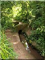
Bridge on Roselands Road
This public footpath, here crossing a tiny brook, is shown as a road on old maps. The path connects the Roselands estate with Grange Road at Goodrington via pleasant open fields.
Image: © Derek Harper
Taken: 1 Aug 2008
0.19 miles
7
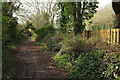
Roselands Road, Goodrington
Further west along footpath PN3 from where Image] was taken.
Image: © Derek Harper
Taken: 6 Apr 2019
0.19 miles
8

Common figwort
Scrophularia nodosa is an impressively tall if rather gawky plant, and its flowers are tiny, but a beautiful colour. Here it is growing in damp conditions in the valley of the stream shown in Image
Image: © Derek Harper
Taken: 1 Aug 2008
0.19 miles
9
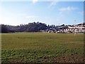
Sports pitches, Torbay Leisure Centre
Several well maintained pitches for football and rugby are laid out here.
The wooded hill beyond is Clennon Hill.
Image: © Richard Dorrell
Taken: 2 Jan 2009
0.20 miles
10
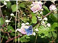
Blue butterfly near Grange Court
A species of blue on a bramble flower, taken a little west of Image
Image: © Derek Harper
Taken: 1 Aug 2008
0.21 miles