
IMAGES TAKEN NEAR TO
Totnes Road, PAIGNTON, TQ4 7DE
Introduction
This page details the photographs taken nearby to Totnes Road, TQ4 7DE by members of the Geograph project.
The Geograph project started in 2005 with the aim of publishing, organising and preserving representative images for every square kilometre of Great Britain, Ireland and the Isle of Man.

There are currently over 7.5m images from over14,400 individuals and you can help contribute to the project by visiting https://www.geograph.org.uk
Image Map
Images are licensed for reuse under creativecommons.org/licenses/by-sa/2.0
Notes
- Clicking on the map will re-center to the selected point.
- The higher the marker number, the further away the image location is from the centre of the postcode.
Image Listing (61 Images Found)
Images are licensed for reuse under creativecommons.org/licenses/by-sa/2.0
Image
Details
Distance

3
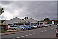
Ocean Torbay
Sorry - not a seaside picture, but Ocean is the name of this BMW and Mini new and used car dealership in Totnes Road.
Image: © Richard Dorrell
Taken: 15 Sep 2015
0.04 miles
4
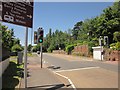
Pedestrian crossing, Collaton St Mary
On the very busy A385 - I managed to find a reasonable gap in the traffic. The large sign at top left refers to a junction at the bend in the road ahead.
Image: © Derek Harper
Taken: 18 Jun 2015
0.04 miles
5
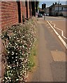
Mexican Fleabane, Collaton St Mary
In the background is Image
Image: © Derek Harper
Taken: 18 Jun 2015
0.05 miles
7
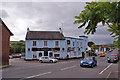
The Parkers Arms public house
Located in Totnes Road at its junction with Stoke Road. The pub takes its name from the Parker Family of Whiteway, who bought the Collaton estate in the 1600s.
Image: © Richard Dorrell
Taken: 15 Sep 2015
0.06 miles
9
Parkers Arms, Collaton St Mary
Image: © Derek Harper
Taken: 21 Jun 2017
0.08 miles
10
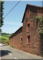
Listed farmyard buildings, Collaton St Mary
Listed as "planned farmyard to Collaton Farmhouse" https://www.historicengland.org.uk/listing/the-list/list-entry/1208451 . The buildings dominate the junction of Stoke Road and Totnes Road.
Image: © Derek Harper
Taken: 21 Jun 2017
0.08 miles