
IMAGES TAKEN NEAR TO
Stoke Road, PAIGNTON, TQ4 7DD
Introduction
This page details the photographs taken nearby to Stoke Road, TQ4 7DD by members of the Geograph project.
The Geograph project started in 2005 with the aim of publishing, organising and preserving representative images for every square kilometre of Great Britain, Ireland and the Isle of Man.

There are currently over 7.5m images from over14,400 individuals and you can help contribute to the project by visiting https://www.geograph.org.uk
Image Map
Images are licensed for reuse under creativecommons.org/licenses/by-sa/2.0
Notes
- Clicking on the map will re-center to the selected point.
- The higher the marker number, the further away the image location is from the centre of the postcode.
Image Listing (62 Images Found)
Images are licensed for reuse under creativecommons.org/licenses/by-sa/2.0
Image
Details
Distance
1
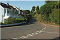
Stoke Road
From the junction shown in Image], looking left.
Image: © Derek Harper
Taken: 31 Jul 2020
0.01 miles
2
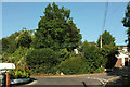
Junction, Stoke Road
The road to Stoke Gabriel swings left at the junction with St Mary's Park.
Image: © Derek Harper
Taken: 31 Jul 2020
0.03 miles
3
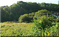
Meadow and trees near St Mary's Park
Looking right from Image Stoke Road bends around the southern end of the meadow towards the junction shown in Image
Image: © Derek Harper
Taken: 31 Jul 2020
0.04 miles
4
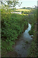
Yalberton Stream
From where it runs beneath Stoke Road, looking upstream. Across the meadow is the rear of Image
Image: © Derek Harper
Taken: 31 Jul 2020
0.05 miles
5
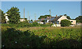
St Mary's Park
A similar view to Image], taken a bit further south along Stoke Road.
Image: © Derek Harper
Taken: 31 Jul 2020
0.06 miles
6
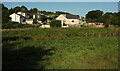
St Mary's Park
The cul-de-sac on the outskirts of Collaton St Mary seen from Stoke Road across a meadow, also shown at Image, and the Yalberton Stream.
Image: © Derek Harper
Taken: 31 Jul 2020
0.07 miles
7
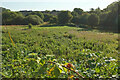
Meadow by Yalberton Stream
From the east end of St Mary's Park. Image] was taken from the gate right of centre.
Image: © Derek Harper
Taken: 31 Jul 2020
0.07 miles
8

Towards St Mary's Park
Looking left from Image], towards a cul-de-sac that heads into the countryside. Behind it is Windmill Hill.
Image: © Derek Harper
Taken: 4 Jun 2020
0.09 miles
9
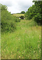
Meadow, Collaton St Mary
From a gateway on Stoke Road.
Image: © Derek Harper
Taken: 4 Jun 2020
0.10 miles
10
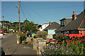
St Mary's Park
Taken about a quarter the way along the cul-de-sac, which has just under 100 properties.
Image: © Derek Harper
Taken: 31 Jul 2020
0.10 miles