
IMAGES TAKEN NEAR TO
Hill Park Terrace, PAIGNTON, TQ4 6EX
Introduction
This page details the photographs taken nearby to Hill Park Terrace, TQ4 6EX by members of the Geograph project.
The Geograph project started in 2005 with the aim of publishing, organising and preserving representative images for every square kilometre of Great Britain, Ireland and the Isle of Man.

There are currently over 7.5m images from over14,400 individuals and you can help contribute to the project by visiting https://www.geograph.org.uk
Image Map
Images are licensed for reuse under creativecommons.org/licenses/by-sa/2.0
Notes
- Clicking on the map will re-center to the selected point.
- The higher the marker number, the further away the image location is from the centre of the postcode.
Image Listing (320 Images Found)
Images are licensed for reuse under creativecommons.org/licenses/by-sa/2.0
Image
Details
Distance
1

Up Hill Park Terrace, Paignton
Hill Park Terrace ascends from Sands Road. St Andrew's church hall https://www.geograph.org.uk/photo/5735223 is on the left.
Image: © Jaggery
Taken: 2 Apr 2018
0.04 miles
2
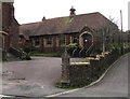
St Andrew's church hall, Paignton
Steps lead up to the hall entrance centre right.
Steps on the left lead to a church entrance.
Hill Park Terrace https://www.geograph.org.uk/photo/5735227 is on the right.
Image: © Jaggery
Taken: 2 Apr 2018
0.05 miles
3
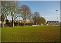
Playing Field & Pullman
Looking across one of the pitches of Paignton Rugby Club http://www.pitchero.com/clubs/paigntonjuniorrfc/ towards the Dartmouth Steam Railway http://www.dartmouthrailriver.co.uk/
Image: © Glyn Baker
Taken: 30 Mar 2012
0.06 miles
4
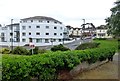
Sands Road
Viewed at the junction with Whitstone Road from a train on the Dartmouth Steam Railway.
Image: © Mary and Angus Hogg
Taken: 29 Jun 2016
0.06 miles
5
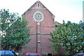
St. Andrew's Church
St. Andrew's Church is a Grade II Listed building - This text from http://britishlistedbuildings.co.uk/en-383851-parish-church-of-st-andrew-paignton
Parish church. 1892-1897 to the designs of Fulford, Tait and
Harvey; W end completed by WD Caroe 1929-1930. Tall town
church in Free French Gothic style with Arts and Crafts
details.
MATERIALS: Local red snecked breccia with yellow sandstone
dressings; red tile roof; original cast-iron rainwater goods.
PLAN: Nave; chancel; N and S two-bay transepts; N and S
five-and-a-half bay aisles; NE lady chapel; SE vestry;
entrance on SW side.
EXTERIOR: Deep battered plinth. Buttressed chancel with
central buttress with set-offs and gable below traceried
roundel window. Basement level with ogival-headed slit windows
and doorways with depressed ogival heads.
S return of chancel has unusual paired lancet window in stone
recess with buttress-like detail in the centre; gabled stone
bellcote.
Lady Chapel has semi-circular end and a conical tiled roof; 3
trefoil-headed windows in round-headed arches with moulded
string below the sills.
Easternmost bay of north aisle is the heavily buttressed base
of the unconstructed tower and has been roofed over with a
hipped roof with deep eaves on timber brackets above louvred
panels.
N transept has 2 gables to the N with round windows with free
flamboyant tracery. N aisle divided between 2 eastern bays,
buttressed with lean-to roof and a western section containing
the baptistry.
Eastern bays have square-headed 3-light windows, baptistry has
2-light transomed window with cusped lights in a square-headed
frame.
Nave has a clerestorey with 2 pairs of windows to each
buttressed bay, windows with cusped arched heads. S side has a
similar transept and 2-bay eastern section to aisle.
To the west there is a S porch with a canted corner and
segmental-headed arch, 3-light square-headed cusped window
above.
East end has flat-roofed wrap-around vestry with a parapet and
small 2- and 3-light windows with a doorway on the east
return.
West end is buttressed with a 2-light window in a 3-centred
stone frame, each light with Y tracery and cusped head,
traceried roundel in square frame in gable.
Steps up to projecting W porch with angle buttresses and a
moulded arched doorway recessed under a segmental stone arch
which acts as a porch hood.
INTERIOR: Moulded chancel arch on shafts supported on corbels
carved with 6-winged angles. Moulded arches to arcades which
have alternating octagonal and cylindrical piers with detached
Purbeck shafts. Clerestory windows have internal
trefoil-headed arches on shafts. Chancel has a 2-bay archway
into the Lady Chapel with a blind vessica in the tympanum.
Keeled roofs to transepts; keeled boarded wagon roof to nave.
FITTINGS: 1950s reredos, mosaic chancel floor, sedilia with
timber canopy, choir stalls with carved bench ends; marble
chancel rail with brattished ironwork. Lavish pulpit by Hems
and Son of Exeter with an octagonal bowl with inlaid marble
and alabaster figures in niches. Octagonal late medieval font,
formerly at the medieval parish church of St John the Baptist,
with a C15 bowl on a replaced stem. Elaborate timber font
cover to Caroe's designs, dated 1912 (disused at time of
survey) with figures in niches and crocketed pinnacles and
gables.
STAINED GLASS: Good set of late C19 stained glass and
attractive Art Nouveau leaded glass in the heads of some of
the plain windows.
(Buildings of England: Pevsner N: Devon: London: 1952-1989:
836).
Image: © Paul Hutchinson
Taken: 5 Dec 2010
0.06 miles
6
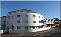
Tor Sands
The buildings contains 23 flats, and stands beside a miniroundabout at the junction of Sands Road and Whitstone Road (right).
Image: © Derek Harper
Taken: 21 Oct 2010
0.06 miles
7
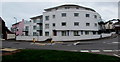
Tor Sands, Paignton
Flats on the corner of Sands Road and Whitstone Road.
Image: © Jaggery
Taken: 2 Apr 2018
0.06 miles
8
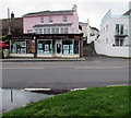
Sands Road Picture Framing, Paignton
At 10-12 Sands Road.
Image: © Jaggery
Taken: 2 Apr 2018
0.06 miles
9
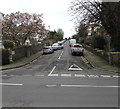
Up St Andrew's Road, Paignton
St Andrew's Road ascends from the south side of Sands Road.
Image: © Jaggery
Taken: 2 Apr 2018
0.07 miles
10

West side of St Andrew's Church, Paignton
Viewed across Sands Road past the Hill Park Terrace junction.
The Church of St Andrew is part of the Church of England Diocese of Exeter.
The church was built in 1892-1897, completed in 1929-1930. Grade II listed in 1993.
Image: © Jaggery
Taken: 2 Apr 2018
0.07 miles