
IMAGES TAKEN NEAR TO
The Esplanade, PAIGNTON, TQ4 6ED
Introduction
This page details the photographs taken nearby to The Esplanade, TQ4 6ED by members of the Geograph project.
The Geograph project started in 2005 with the aim of publishing, organising and preserving representative images for every square kilometre of Great Britain, Ireland and the Isle of Man.

There are currently over 7.5m images from over14,400 individuals and you can help contribute to the project by visiting https://www.geograph.org.uk
Image Map
Images are licensed for reuse under creativecommons.org/licenses/by-sa/2.0
Notes
- Clicking on the map will re-center to the selected point.
- The higher the marker number, the further away the image location is from the centre of the postcode.
Image Listing (614 Images Found)
Images are licensed for reuse under creativecommons.org/licenses/by-sa/2.0
Image
Details
Distance
1

Vanilla Lounge, Paignton
Hair salon on the corner of Roundham Road and Eastern Esplanade.
Image: © Jaggery
Taken: 2 Apr 2018
0.00 miles
2
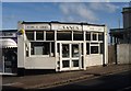
Sands Fish & Chips, Paignton
Perhaps this chippy (which is next to Image, right) only opens during the high season.
Image: © Derek Harper
Taken: 31 Oct 2008
0.01 miles
3
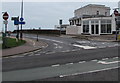
Western end of Eastern Esplanade, Paignton
Signs indicate No Entry except cycles. A cycle lane is on the left side of Eastern Esplanade.
Image: © Jaggery
Taken: 2 Apr 2018
0.01 miles
4
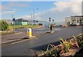
Roundabout, Paignton seafront
A mini-roundabout at the southern end of the seafront, seen from Sands Road, the B3201, which bears left here along Eastern Esplanade. On the right is a small semi-circular building housing a hair salon. As the sign indicates, the Eastern Esplanade, the true seafront road curving behind the shelter on the left, is one-way southwards.
Image: © Derek Harper
Taken: 3 Mar 2014
0.01 miles
5
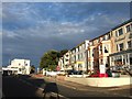
Sands Road, Paignton
A row of guest houses at the eastern end of the road where it meets the Esplanade (left) and Roundham Road (ahead). On the left, shining in the late evening sun, is Image
Image: © Derek Harper
Taken: 1 Aug 2010
0.01 miles
6
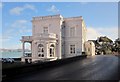
The Paignton Club
Also shown in http://www.geograph.org.uk/search.php?i=47523897 , and described at http://list.english-heritage.org.uk/resultsingle.aspx?uid=1208205&searchtype=mapsearch .
Image: © Derek Harper
Taken: 3 Mar 2014
0.02 miles
7
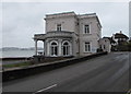
Grade II listed Paignton Club, Paignton
Purpose-built club in the Classical style, dating from 1881. Grade II listed in 1951.
Image: © Jaggery
Taken: 2 Apr 2018
0.02 miles
9
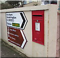
Queen Elizabeth II postbox and direction signs on a Paignton wall
Located here https://www.geograph.org.uk/photo/5778971 in a wall of The Sands B&B at 32 Sands Road.
Image: © Jaggery
Taken: 2 Apr 2018
0.02 miles
10
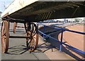
Machine, Paignton
A view beneath the contraption shown in http://www.geograph.org.uk/search.php?i=16383556 , here resting at the southern end of Paignton Sands.
Image: © Derek Harper
Taken: 21 Oct 2010
0.02 miles