
IMAGES TAKEN NEAR TO
Jasmine Grove, PAIGNTON, TQ3 3TH
Introduction
This page details the photographs taken nearby to Jasmine Grove, TQ3 3TH by members of the Geograph project.
The Geograph project started in 2005 with the aim of publishing, organising and preserving representative images for every square kilometre of Great Britain, Ireland and the Isle of Man.

There are currently over 7.5m images from over14,400 individuals and you can help contribute to the project by visiting https://www.geograph.org.uk
Image Map
Images are licensed for reuse under creativecommons.org/licenses/by-sa/2.0
Notes
- Clicking on the map will re-center to the selected point.
- The higher the marker number, the further away the image location is from the centre of the postcode.
Image Listing (81 Images Found)
Images are licensed for reuse under creativecommons.org/licenses/by-sa/2.0
Image
Details
Distance
1
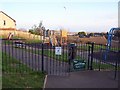
Children's playpark
Although named 'Smallcombe Road' on the sign, the gate seen here is just off Jasmine Grove.
The footpath to the right leads to Smallcombe Road.
Very hazily visible on the horizon is the sea and Berry Head.
Image: © Richard Dorrell
Taken: 28 Dec 2008
0.03 miles
2
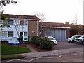
Foxhole Clinic and ambulance station
An NHS clinic with small ambulance station alongside, located in a residential area of Paignton.
Image: © Richard Dorrell
Taken: 28 Dec 2008
0.06 miles
3
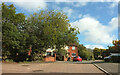
Jasmine Grove, Paignton
Passing Abelia Grove on the left.
Image: © Derek Harper
Taken: 7 Oct 2022
0.07 miles
4
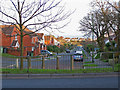
Smallcombe Road
There is no access to the A380 King's Ash Road at this end of Smallcombe Road.
Image: © Richard Dorrell
Taken: 28 Dec 2008
0.09 miles
5
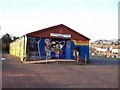
Foxhole Community Centre
With decoration possibly provided by the youth club?
Image: © Richard Dorrell
Taken: 28 Dec 2008
0.10 miles
6
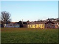
Sports field, Foxhole
The sports field is in the centre of the Foxhole community, accessed from Belfield Road.
The building to the right is the Community Centre. To the left is the sports pavilion.
Both have been brightly decorated with artwork probably by teenagers.
Image: © Richard Dorrell
Taken: 28 Dec 2008
0.11 miles
7
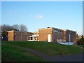
St Boniface Community Church and Hall
Located in Belfield Road, in the heart of the Foxhole estate.
Image: © Richard Dorrell
Taken: 28 Dec 2008
0.11 miles
8
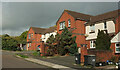
Houses, Smallcombe Road, Paignton
Looking right from Image
Image: © Derek Harper
Taken: 7 Oct 2022
0.12 miles
9
Spruce Way, Paignton
Part of a modern development adjacent to the Torbay by-pass
Image: © David Smith
Taken: 30 Mar 2013
0.12 miles
10
Marldon : Spruce Way
Off Kings Ash Road.
Image: © Lewis Clarke
Taken: 31 Jul 2022
0.12 miles