
IMAGES TAKEN NEAR TO
Clifton Road, PAIGNTON, TQ3 3LD
Introduction
This page details the photographs taken nearby to Clifton Road, TQ3 3LD by members of the Geograph project.
The Geograph project started in 2005 with the aim of publishing, organising and preserving representative images for every square kilometre of Great Britain, Ireland and the Isle of Man.

There are currently over 7.5m images from over14,400 individuals and you can help contribute to the project by visiting https://www.geograph.org.uk
Image Map
Images are licensed for reuse under creativecommons.org/licenses/by-sa/2.0
Notes
- Clicking on the map will re-center to the selected point.
- The higher the marker number, the further away the image location is from the centre of the postcode.
Image Listing (13 Images Found)
Images are licensed for reuse under creativecommons.org/licenses/by-sa/2.0
Image
Details
Distance
1
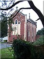
Monastery chapel
The chapel was in use as a community centre between 1978 and 2000.
There is information about the chapel with Paul Hutchinson's image at Image .
Image: © Richard Dorrell
Taken: 29 Dec 2008
0.11 miles
2
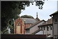
Old monastery chapel
The former monastery chapel at the top of Winner Hill overlooking Paignton. The monastery was occupied by a community from the Order of Mary (Marists). The statue on the eastern end was once a prominent feature which could be seen from most of the town of Paignton, but has become obscured by surrounding trees in recent years.
Image: © Paul Hutchinson
Taken: 18 Dec 2008
0.12 miles
3
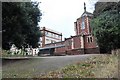
Old monastery buildings
The former monastery at the top of Winner Hill overlooking Paignton. The monastery was occupied by a community from the Order of Mary (Marists). The statue on the eastern end was once a prominent feature which could be seen from most of the town of Paignton, but has become obscured by surrounding trees in recent years.
Image: © Paul Hutchinson
Taken: 18 Dec 2008
0.13 miles
4
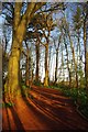
A Primley Path
This path is in Primley Nature Reserve
Image: © Glyn Baker
Taken: 2 Apr 2012
0.15 miles
5
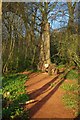
For the Woodpeckers
In previous decades dead trees like this would have been tidied away. Now they are left to encourage invertebrates which woodpeckers love to eat.
Image: © Glyn Baker
Taken: 2 Apr 2012
0.15 miles
6
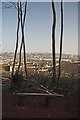
Primley Viewpoint
The underbrush has been cleared so on can have a view from the seat.
Image: © Glyn Baker
Taken: 2 Apr 2012
0.17 miles
7
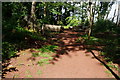
Path in Primly Park
This small nature reserve had many small paths.
Image: © jeff collins
Taken: 11 Jun 2014
0.18 miles
8
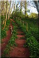
Stairs & Wild Garlic
The bear earth here shows why Paignton's beaches are of red sand. These steps are in Primley Park Nature Reserve.
Image: © Glyn Baker
Taken: 2 Apr 2012
0.18 miles
9
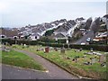
View from the cemetery
From within Paignton cemetery, with housing in Berry Road and Berry Avenue in the background.
If not for the mist, the sea in Torbay would be visible on the horizon on the left.
Image: © Richard Dorrell
Taken: 29 Dec 2008
0.20 miles
10
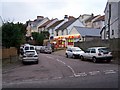
Corner shop, Elm Park
The shop is close to the junction between Elm Park and Colley End Road.
Image: © Richard Dorrell
Taken: 29 Dec 2008
0.20 miles