
IMAGES TAKEN NEAR TO
Southfield Road, PAIGNTON, TQ3 2SR
Introduction
This page details the photographs taken nearby to Southfield Road, TQ3 2SR by members of the Geograph project.
The Geograph project started in 2005 with the aim of publishing, organising and preserving representative images for every square kilometre of Great Britain, Ireland and the Isle of Man.

There are currently over 7.5m images from over14,400 individuals and you can help contribute to the project by visiting https://www.geograph.org.uk
Image Map
Images are licensed for reuse under creativecommons.org/licenses/by-sa/2.0
Notes
- Clicking on the map will re-center to the selected point.
- The higher the marker number, the further away the image location is from the centre of the postcode.
Image Listing (225 Images Found)
Images are licensed for reuse under creativecommons.org/licenses/by-sa/2.0
Image
Details
Distance
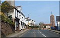
2
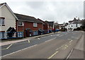
Towards a bend in Cecil Road, Paignton
West along the B3060 Cecil Road.
Image: © Jaggery
Taken: 2 Apr 2018
0.07 miles
3
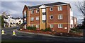
Killerton Close, Paignton
These flats are at the junction of Mill Lane with Cecil Road (Colley End Road turns into Cecil Road about here, heading off to the left). To their right, the cul-de-sac leads to a further block.
Image: © Derek Harper
Taken: 22 Nov 2007
0.07 miles
4
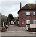
Entrance to Sacred Heart Roman Catholic Nursery & Primary School, Paignton
School & nursery entrance road from Cecil Road past the edge of the presbytery (priests' house). https://www.geograph.org.uk/photo/5725740
https://www.geograph.org.uk/photo/5725765 to the school name sign on the right.
Image: © Jaggery
Taken: 2 Apr 2018
0.09 miles
5
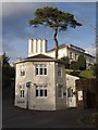
Toll house, Paignton
Pepperpot Cottage is at the foot of Shorton Road, where it joins Southfield Road. The asymmetrically octagonal neo-Tudor toll house is described at https://historicengland.org.uk/listing/the-list/list-entry/1195243 .
Image: © Derek Harper
Taken: 22 Nov 2007
0.09 miles
6
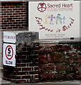
Sacred Heart name sign, Paignton
On the right here https://www.geograph.org.uk/photo/5725758 the Sacred Heart Roman Catholic Nursery & Primary School name sign faces Cecil Road.
Image: © Jaggery
Taken: 2 Apr 2018
0.09 miles
7
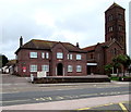
Presbytery, Cecil Road, Paignton
The priests' house was built in 1938, seven years after the Catholic Church of the Sacred Heart & St Thérèse of the Child Jesus on the right https://www.geograph.org.uk/photo/5725735 first opened for worship.
Image: © Jaggery
Taken: 2 Apr 2018
0.10 miles
8
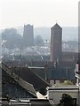
Church towers, seen from Oldway mansion, Paignton
Two church towers, the one further away being the older, are brought closer by the camera's zoom lens. These can be seen from the southerly end of the formal gardens at Oldway mansion.
Image: © Tom Jolliffe
Taken: 17 Feb 2008
0.10 miles
9
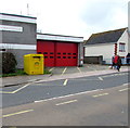
Yellow bin outside Paignton Fire Station
The bin is a clothing & shoe bank for donations to the Fire Fighters Charity.
Image: © Jaggery
Taken: 2 Apr 2018
0.10 miles
10
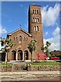
Catholic Church
Church of the Sacred Heart and St Teresa. Seen across the B3060, Cecil Road.
Image: © jeff collins
Taken: 29 Sep 2023
0.10 miles