IMAGES TAKEN NEAR TO
Seaway Crescent, PAIGNTON, TQ3 2PD
Introduction
This page details the photographs taken nearby to Seaway Crescent, TQ3 2PD by members of the Geograph project.
The Geograph project started in 2005 with the aim of publishing, organising and preserving representative images for every square kilometre of Great Britain, Ireland and the Isle of Man.

There are currently over 7.5m images from over14,400 individuals and you can help contribute to the project by visiting https://www.geograph.org.uk
Image Map
Images are licensed for reuse under creativecommons.org/licenses/by-sa/2.0
Notes
- Clicking on the map will re-center to the selected point.
- The higher the marker number, the further away the image location is from the centre of the postcode.
Image Listing (364 Images Found)
Images are licensed for reuse under creativecommons.org/licenses/by-sa/2.0
Image
Details
Distance
1
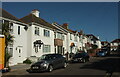
Orient Road, Preston
A one-way road that links Torbay Road to Seaway Road (behind the camera) via the right-angled bend seen ahead.
Image: © Derek Harper
Taken: 26 Feb 2021
0.02 miles
2
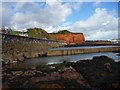
Paignton - Red Cliff
An outcrop of red cliff protected by manmade defences.
Image: © Chris Talbot
Taken: 21 Oct 2009
0.04 miles
3
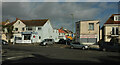
Junction on Seaway Road, Preston
The junction and the care agency can be seen in Image Across Seaway Road is Orient Road; both are one-way.
Image: © Derek Harper
Taken: 29 Jan 2021
0.05 miles
4
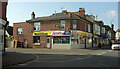
Exeter Handyman at Tyrrells, Preston
Delighted to see the Exeter Handyman name is still going, always our go to hardware shop for several decades after moving to Torbay. Here it replaces the shop shown in Image On the left is Eugene Road, to the right is Seaway Road. These form the westbound part of the A3022.
Image: © Derek Harper
Taken: 1 Mar 2021
0.05 miles
6
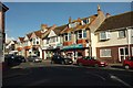
Shops, Preston
On the northeast side of Seaway Road, the A3022 which is part of the one-way system around Preston.
Image: © Derek Harper
Taken: 18 Jan 2017
0.05 miles
9
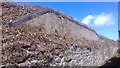
Remains of Preston Platform, Paignton
The remains of Preston Platform, sometimes called Preston 'Halt'. Opened on July 24th 1911, it closed three years later on September 21st 1914. The railway line between Torquay and Paignton was built in 1859. The 'Halt' was built in response to the competition from the new tram service that started in 1911. The 'Halt' accommodated visitors visiting Preston Sands opposite, before the current houses were built. Today the remains of the platform can be found in the path behind the houses on Marine Parade. Approaching this location the original entrance is the 'block work' gap in the stone wall. When the overgrown vegetation dies back the GWR grey bull nose engineering bricks on the back edge of the platform can be seen, with the path leading up from the public path.
Image: © John C
Taken: 21 Sep 2018
0.06 miles