
IMAGES TAKEN NEAR TO
Loventor Crescent, PAIGNTON, TQ3 1LT
Introduction
This page details the photographs taken nearby to Loventor Crescent, TQ3 1LT by members of the Geograph project.
The Geograph project started in 2005 with the aim of publishing, organising and preserving representative images for every square kilometre of Great Britain, Ireland and the Isle of Man.

There are currently over 7.5m images from over14,400 individuals and you can help contribute to the project by visiting https://www.geograph.org.uk
Image Map
Images are licensed for reuse under creativecommons.org/licenses/by-sa/2.0
Notes
- Clicking on the map will re-center to the selected point.
- The higher the marker number, the further away the image location is from the centre of the postcode.
Image Listing (57 Images Found)
Images are licensed for reuse under creativecommons.org/licenses/by-sa/2.0
Image
Details
Distance
1

Leader Lane, Marldon
A public access route heading for Westerland.
Image: © Derek Harper
Taken: 31 Aug 2020
0.05 miles
2
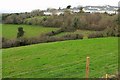
New view near Marldon
One of the side valleys at the head of the Westerland valley, seen from the same spot as Image The houses are on Gentian Close.
Image: © Derek Harper
Taken: 15 Jan 2017
0.06 miles
3
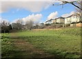
Path to Leader Lane
Marldon Footpath 17, from which Image] was taken of the houses on the right.
Image: © Derek Harper
Taken: 24 Feb 2014
0.06 miles
4
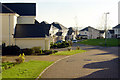
New Housing, Marldon
Quality housing development off Torbay ring road on the site of a former holiday park
Image: © Crispin Purdye
Taken: 17 Nov 2005
0.06 miles
5
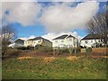
Houses at Marldon
Detached houses, each with their own little conservatory, on Brockhurst Park overlooking a green space. Seen from Marldon Footpath 17.
Image: © Derek Harper
Taken: 24 Feb 2014
0.07 miles
6

A drink or two at Ye Olde Smokey House, Churscombe
Translucent pints at the pub shown in Image; a good way to end a walk.
Image: © Derek Harper
Taken: 11 Apr 2012
0.07 miles
7
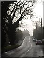
Vicarage Road, Marldon
On a foggy day, with the sun almost breaking through. Now bypassed by Marldon Way to the east, Vicarage Road once formed part of the route by which traffic heading to Brixham avoided the coastal towns.
Image: © Derek Harper
Taken: 14 Jan 2010
0.08 miles
8
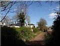
Leader Lane, Marldon
A pleasant little track, running between tree-lined banks for the most part, linking Westerland Green with Middle Westerland Cross. The houses on the left are on Churscombe Park.
Image: © Derek Harper
Taken: 5 Apr 2008
0.08 miles
9
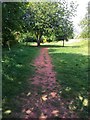
Path to Leader Lane
From Churscombe Cross.
Image: © jeff collins
Taken: 8 Jun 2020
0.08 miles
10

Lichen near Churscombe
Fog, a result of a thaw following the previous week's snowfalls, is condensing on foliage and everything is dripping gently.
Image: © Derek Harper
Taken: 14 Jan 2010
0.08 miles