IMAGES TAKEN NEAR TO
Southern Close, TORQUAY, TQ2 8QJ
Introduction
This page details the photographs taken nearby to Southern Close, TQ2 8QJ by members of the Geograph project.
The Geograph project started in 2005 with the aim of publishing, organising and preserving representative images for every square kilometre of Great Britain, Ireland and the Isle of Man.

There are currently over 7.5m images from over14,400 individuals and you can help contribute to the project by visiting https://www.geograph.org.uk
Image Map
Images are licensed for reuse under creativecommons.org/licenses/by-sa/2.0
Notes
- Clicking on the map will re-center to the selected point.
- The higher the marker number, the further away the image location is from the centre of the postcode.
Image Listing (94 Images Found)
Images are licensed for reuse under creativecommons.org/licenses/by-sa/2.0
Image
Details
Distance
1
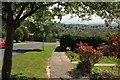
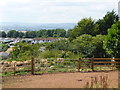
Swedwell Road, Watcombe
Curving downhill with a neat verge, and a fine view of Torquay. It's quite breezy up here, with leaves being dislodged from the tree.
Image: © Derek Harper
Taken: 2 Jun 2016
0.06 miles
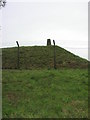
2
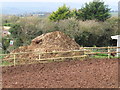
Dunghill on Great Hill, Torquay
There are horses in the field next to the dung heap.
Image: © David Hawgood
Taken: 16 Nov 2013
0.06 miles
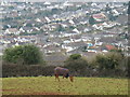
3
Lower section of a bare earth paddock
The prolonged hot July has reduced the paddock to bare earth.
Image: © John C
Taken: 14 Jul 2018
0.06 miles
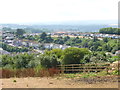
4
Horse on Great Hill, Torquay
View down over Padacre Road. Great Hill is on the edge of open country.
Image: © David Hawgood
Taken: 14 Feb 2010
0.06 miles
5
Grassless paddock, top end
The hot weather this month has reduced the paddock to bare earth.
Image: © John C
Taken: 14 Jul 2018
0.07 miles
6
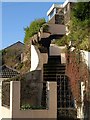
Steps on Padacre Road, Torquay
The price you pay for the best view is a long flight of steps up from the pavement.
Image: © Derek Harper
Taken: 22 Dec 2009
0.08 miles
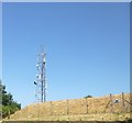
7
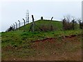
Great Hill, Torquay. - Trig. Point
Great Hill is the highest point in Torquay / Torbay, approx 164m above sea level.
In 1825 a Popham semaphore signal station for the Admiralty's Plymouth to London semaphore line. The station was identified as Roccombe.
Image: © John C
Taken: 16 Dec 2008
0.08 miles
8
One side of the Great Hill underground reservoir
An access gate can be seen on the right of the photograph.
Image: © John C
Taken: 14 Jul 2018
0.09 miles
9
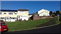
Golden Park Ave - Swedwell Rd junction
Looking NW at the triangle of grass at the junction of Golden Park Avenue
Image: © John C
Taken: 7 Mar 2018
0.09 miles
10
Great Hill
Trig in resecured compound once again. Dry grey morning.
Name: Great Hill
Hill number: 5414
Height: 180m / 591ft
Area: 40: Cornwall & Devon
Class: Hu
Grid ref: SX 91207 67973
Summit feature: trig point: OS measurement
Drop: 128m
Col: 52m SX900660
Image: © Rude Health
Taken: 14 Mar 2012
0.09 miles