IMAGES TAKEN NEAR TO
Queensway, TORQUAY, TQ2 6DF

Introduction

This page details the photographs taken nearby to Queensway, TQ2 6DF by members of the Geograph project.

The Geograph project started in 2005 with the aim of publishing, organising and preserving representative images for every square kilometre of Great Britain, Ireland and the Isle of Man.

There are currently over 7.5m images from over14,400 individuals and you can help contribute to the project by visiting https://www.geograph.org.uk

Image Map


Images are licensed for reuse under creativecommons.org/licenses/by-sa/2.0
Notes
  • Clicking on the map will re-center to the selected point.
  • The higher the marker number, the further away the image location is from the centre of the postcode.

Image Listing (681 Images Found)

Images are licensed for reuse under creativecommons.org/licenses/by-sa/2.0
  • ...
Image
Details
Distance
1
Drive to the Rainbow in the snow, Torquay
A similar scene without the snow is at Image
Image: © Derek Harper Taken: 19 Mar 2018
0.02 miles
2
Maintenance vehicles, Rainbow Drive
Connected with the impending roadworks promised at Image A rather different view of the drive, looking in the other direction, is at Image The distant white van is on Shiphay Lane.
Image: © Derek Harper Taken: 17 Nov 2020
0.03 miles
3
Queensway Crescent
Seen in the snow, a somewhat triangular loop of modern sets of three houses close to the top of the steep hill at the northern end of Queensway.
Image: © Derek Harper Taken: 9 Jan 2010
0.03 miles
4
Trees behind Queensway, Torquay
On the steep slope above the drive to the Rainbow.
Image: © Derek Harper Taken: 22 Jun 2014
0.03 miles
5
Trees on Rainbow Drive
Filtering winter sunlight, these mature trees tower over the drive leading from Shiphay Lane to The Rainbow.
Image: © Derek Harper Taken: 11 Feb 2014
0.04 miles
6
Abandoned cars, Shiphay Bridge
These cars shouldn't be parked here, but parking enforcement has been waived for a while to give owners a chance to recover their vehicles after driving became impossible the previous day.
Image: © Derek Harper Taken: 19 Mar 2018
0.04 miles
7
Drive to the Rainbow
New fencing has been erected here in conjunction with work to create a cycle path through Queen's Wood, on the left. As you can see, trees have been felled.
Image: © Derek Harper Taken: 28 Feb 2015
0.04 miles
8
Railway line north of Torre
The line climbing the valley northwards, with the bridge carrying Shiphay Lane visible around the bend. The houses are on Newton Road.
Image: © Derek Harper Taken: 9 Jan 2010
0.04 miles
9
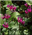
Cyclamen by the road to The Rainbow
Garden escapes flourishing alongside the road from Shiphay Lane, sandwiched between Queensway and the railway line.
Image: © Derek Harper Taken: 15 Apr 2011
0.04 miles
10
Train approaching Torre
I'm not going to pretend; this is the rear of a FGW service to Paignton, seen from the Shiphay lane bridge. The service has come from London Paddington.
Image: © Derek Harper Taken: 19 Nov 2013
0.04 miles
  • ...