
IMAGES TAKEN NEAR TO
Bitton Park Road, TEIGNMOUTH, TQ14 9DF
Introduction
This page details the photographs taken nearby to Bitton Park Road, TQ14 9DF by members of the Geograph project.
The Geograph project started in 2005 with the aim of publishing, organising and preserving representative images for every square kilometre of Great Britain, Ireland and the Isle of Man.

There are currently over 7.5m images from over14,400 individuals and you can help contribute to the project by visiting https://www.geograph.org.uk
Image Map
Images are licensed for reuse under creativecommons.org/licenses/by-sa/2.0
Notes
- Clicking on the map will re-center to the selected point.
- The higher the marker number, the further away the image location is from the centre of the postcode.
Image Listing (421 Images Found)
Images are licensed for reuse under creativecommons.org/licenses/by-sa/2.0
Image
Details
Distance
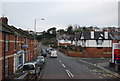
2
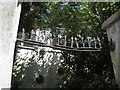
Wrought-iron decoration, Lugehay House, Bitton Park Road, Teignmouth
It spans between the gate pillars, above a wrought-iron garden gate.
Lugehay House was the home of Robert Jordan, the "very sharp" banker, moneylender and scribe, and his wife Nancy some time after they married in 1788. Robert was the moving force behind the draining of the marsh that separated East Teignmouth and West Teignmouth, allowing the development of the modern town centre. Two views of Lugehay House are Image and Image
Image: © Robin Stott
Taken: 6 Jul 2013
0.01 miles
3
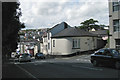
Corner of Reed Vale, Bitton Park Road, Teignmouth
Traffic often queues down this hill. At the bottom there's a zebra crossing outside the Tesco Express, and a bit further on there are traffic lights at the A379 / A381 fork. The dark red house down the hill has an array of solar panels on its roof. The cedar tree is in the grounds of Westbrook Image
Image: © Robin Stott
Taken: 19 Aug 2012
0.01 miles
5
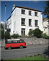
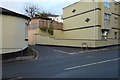
Lugehay House, Bitton Park Road, Teignmouth
A pleasing, 3-bay, 3-storey, probably early 19th-century house, similar to Image
Image: © Robin Stott
Taken: 19 Aug 2012
0.02 miles
6
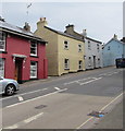
Colourful houses, Bitton Park Road, Teignmouth
On the north side of the A379 Bitton Park Road, between Westbrook Avenue and Reed Vale.
Image: © Jaggery
Taken: 21 Apr 2016
0.02 miles
7
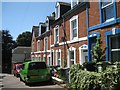
West side of Chelsea Place, Teignmouth
Chelsea Place is a pleasing cul-de-sac to the north of Bitton Park Road. Two terraces of nine houses each face each other across the narrow street. A few have ornamental tiled front paths and steps which have survived. http://www.geograph.org.uk/photo/4056590 http://www.geograph.org.uk/photo/4056595 http://www.geograph.org.uk/photo/4056602 http://www.geograph.org.uk/photo/4056606
Image: © Robin Stott
Taken: 6 Jul 2013
0.02 miles
8
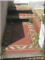
Tiled front path and steps, no.17 Chelsea Place, Teignmouth
Image: © Robin Stott
Taken: 6 Jul 2013
0.02 miles
9
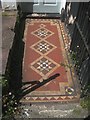
Tiled front path and steps, no.16 Chelsea Place, Teignmouth
Image: © Robin Stott
Taken: 6 Jul 2013
0.02 miles
10
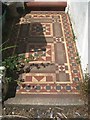
Tiled front path and steps, no.14 Chelsea Place, Teignmouth
Image: © Robin Stott
Taken: 6 Jul 2013
0.02 miles