IMAGES TAKEN NEAR TO
Cliff Walk, TEIGNMOUTH, TQ14 8TR
Introduction
This page details the photographs taken nearby to Cliff Walk, TQ14 8TR by members of the Geograph project.
The Geograph project started in 2005 with the aim of publishing, organising and preserving representative images for every square kilometre of Great Britain, Ireland and the Isle of Man.

There are currently over 7.5m images from over14,400 individuals and you can help contribute to the project by visiting https://www.geograph.org.uk
Image Map (Loading...)


Getting Data...Please wait
Leaflet Map data © OpenStreetMap
Images are licensed for reuse under creativecommons.org/licenses/by-sa/2.0
Notes
- Clicking on the map will re-center to the selected point.
- The higher the marker number, the further away the image location is from the centre of the postcode.
Image Listing (273 Images Found)
Images are licensed for reuse under creativecommons.org/licenses/by-sa/2.0
Image
Details
Distance
1
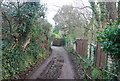
Outbuildings and a caravan, Dingley Dell, Teignmouth
Dingley Dell is a house that nestles in scrub woodland on the east cliff itself, accessed from Eastcliff Walk, which is driveable up to the gate.
Image: © Robin Stott
Taken: 10 Dec 2012
0.01 miles
3
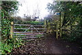
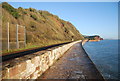
Way out of East Cliff Park
One of several exits from the park. The footpath ahead is an alternative route to the one by the railway line for the South West Coast Path.
Image: © jeff collins
Taken: 11 Feb 2014
0.03 miles
4
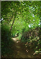
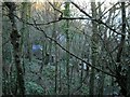
Eastcliff Walk
Followed by the inland coast path.
Image: © Derek Harper
Taken: 30 Aug 2020
0.03 miles
6
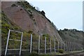
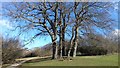
Winding path, top of Eastcliff Park, Teignmouth
The modern houses are in First Drive. The cabinet on the right had no identification; I wondered if it had some connection with Network Rail's ongoing work to stabilise the cliffs above the railway Image
Image: © Robin Stott
Taken: 24 Apr 2022
0.05 miles
7
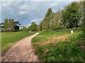
South across Eastcliff Park
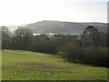
Former grazing land belonging to the Mules family, the rising ground gives a view to Shaldon, the Ness, the Beacon above it and Babbacombe Bay to the left.
Image: © Robin Stott
Taken: 10 Dec 2012
0.05 miles
8
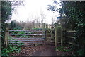
Mules Park, at the top end
Walking North up to the top end of the park
Image: © John C
Taken: 27 Feb 2018
0.05 miles