
IMAGES TAKEN NEAR TO
Dawlish Road, TEIGNMOUTH, TQ14 8FT
Introduction
This page details the photographs taken nearby to Dawlish Road, TQ14 8FT by members of the Geograph project.
The Geograph project started in 2005 with the aim of publishing, organising and preserving representative images for every square kilometre of Great Britain, Ireland and the Isle of Man.

There are currently over 7.5m images from over14,400 individuals and you can help contribute to the project by visiting https://www.geograph.org.uk
Image Map
Images are licensed for reuse under creativecommons.org/licenses/by-sa/2.0
Notes
- Clicking on the map will re-center to the selected point.
- The higher the marker number, the further away the image location is from the centre of the postcode.
Image Listing (204 Images Found)
Images are licensed for reuse under creativecommons.org/licenses/by-sa/2.0
Image
Details
Distance
1
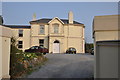
Teignmouth : Brandwood Community Care Home
A care home on Teignmouth Road which among other things offers respite holiday stay.
Image: © Lewis Clarke
Taken: 27 Mar 2011
0.00 miles
2
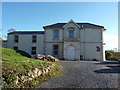
70 Dawlish Road, Teignmouth
A sign at the entrance reads: "Brandwood Community Care / Developing Independence for Young People with Learning Disabilities / [contact details] / Residential Care · Supported Living · Respite · Daycare / [logos of] Paprikia Residential Care Home and Free Spirit Supported Living".
Image: © Robin Stott
Taken: 19 Jan 2014
0.01 miles
3
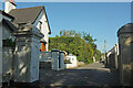
Second Drive, Teignmouth
Looking right from Image] along a cul-de-sac well-documented at http://www.geograph.org.uk/search.php?i=150263648 .
Image: © Derek Harper
Taken: 30 May 2021
0.01 miles
4
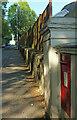
Postbox, Dawlish Road, Teignmouth
George V postbox TQ14 18 is beside the junction with Second Drive. See also Image
Image: © Derek Harper
Taken: 30 May 2021
0.02 miles
5
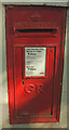
Postbox, Dawlish Road, Teignmouth
George V postbox TQ14 18 is placed in context at Image
Image: © Derek Harper
Taken: 30 May 2021
0.02 miles
6
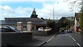
Entrance to Marsland Court on Dawlish Road
Marsland Court is a complex of several buildings. No indicate of their use.
Image: © John C
Taken: 26 Apr 2018
0.02 miles
7
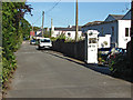
Second Drive, Teignmouth
A short access road off the Dawlish Road. Beacon Court was formerly the Beacon School, a private preparatory school that closed during the 1970s. The house called Llanstephan next down the road was an annex to the school. The old classroom block between the two houses has been converted to a bungalow.
Image: © Alan Hunt
Taken: 12 Jun 2014
0.02 miles
8
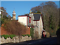
Abbey Lodge, 97 Dawlish Road, Teignmouth
Now a private house, this was the lodge to St Scholastica's Abbey, itself now converted to flats within Highgrove Park. A turret is visible. See Image and Image
Retaining walls! Teignmouth is held up by them. A more recent view is Image
Image: © Robin Stott
Taken: 19 Jan 2014
0.03 miles
9

Former lodge to St Scholastica's Abbey
Also shown in Image and Image, and described at https://historicengland.org.uk/listing/the-list/list-entry/1269126?section=official-listing . On the A379.
Image: © Derek Harper
Taken: 12 Jan 2022
0.03 miles
10
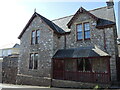
Listed house on Dawlish Road
This house looks quite unremarkable from the outside, but it is a listed building and has an uncomventional interior. To add to that it also has a flush bracket on the outside wall - see Image
Image: © Neil Owen
Taken: 30 Mar 2024
0.03 miles