IMAGES TAKEN NEAR TO
Torquay Road, TEIGNMOUTH, TQ14 0AE

Introduction

This page details the photographs taken nearby to Torquay Road, TQ14 0AE by members of the Geograph project.

The Geograph project started in 2005 with the aim of publishing, organising and preserving representative images for every square kilometre of Great Britain, Ireland and the Isle of Man.

There are currently over 7.5m images from over14,400 individuals and you can help contribute to the project by visiting https://www.geograph.org.uk

Image Map


Images are licensed for reuse under creativecommons.org/licenses/by-sa/2.0
Notes
  • Clicking on the map will re-center to the selected point.
  • The higher the marker number, the further away the image location is from the centre of the postcode.

Image Listing (629 Images Found)

Images are licensed for reuse under creativecommons.org/licenses/by-sa/2.0
  • ...
Image
Details
Distance
1
Main Road in Shaldon
Looking down towards Shaldon from Topcliff Road.
Image: © Wayland Smith Taken: 11 Aug 2013
0.02 miles
2
Cabbage Palm in a front garden, Torquay Road
Cordyline australis was introduced from New Zealand in 1823. It is not a true palm and is currently assigned to the family Asparagaceae; it is related to sisal. (Information from Wikipedia and Mitchell, 1974). It thrives on the southern and western coasts of Britain and Ireland but many specimens in inland gardens were killed in the prolonged cold of the 2010-11 winter. More of the attractive terrace is seen in Image
Image: © Robin Stott Taken: 15 Sep 2011
0.02 miles
3
God save us.....
Ambivalent royal tableau, front garden of No 8 Ringmore Road, Shaldon.
Image: © Robin Stott Taken: 4 Jun 2012
0.02 miles
4
Ringmore Rd
Grade II listed. https://www.britishlistedbuildings.co.uk/101269197-2-8-ringmore-road-shaldon
Image: © N Chadwick Taken: 28 Dec 2017
0.02 miles
5
Shaldon - Toll House
This old toll house is on the junction of two roads which in the past gave the toll keeper the opportunity to collect from the users of both roads.
Image: © Colin Vosper Taken: 6 May 2007
0.03 miles
6
Shaldon - Toll House from Ringmore Road
This toll house was carefully located at the junction of two roads giving the toll house keeper the opportunity to collect fees from the users of both roads. Now it is a private house which has been used as a local guest house. Milestone Society National ID: DV.SHA
Image: © Colin Vosper Taken: 6 May 2007
0.03 miles
7
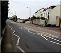
Zigzag white markings on the A379, Shaldon
Marking a no parking zone near this http://www.geograph.org.uk/photo/4918057 zebra crossing. Ahead, the left fork is Torquay Road. The right fork is Ringmore Road.
Image: © Jaggery Taken: 21 Apr 2016
0.03 miles
8
A379
Image: © N Chadwick Taken: 28 Dec 2017
0.03 miles
9
Terrace, Ringmore Road, Shaldon
From across the junction with Torquay Road. The terrace is listed and described in two sections: the right-hand four at https://www.historicengland.org.uk/listing/the-list/list-entry/1269197 , and the three-storey house at the end at https://www.historicengland.org.uk/listing/the-list/list-entry/1269198 . One of the five appears in Image
Image: © Derek Harper Taken: 2 Nov 2016
0.03 miles
10
Ringmore Road, Shaldon
Image: © Ian S Taken: 26 May 2013
0.04 miles
  • ...