
IMAGES TAKEN NEAR TO
Castle Lane, TORQUAY, TQ1 3BE
Introduction
This page details the photographs taken nearby to Castle Lane, TQ1 3BE by members of the Geograph project.
The Geograph project started in 2005 with the aim of publishing, organising and preserving representative images for every square kilometre of Great Britain, Ireland and the Isle of Man.

There are currently over 7.5m images from over14,400 individuals and you can help contribute to the project by visiting https://www.geograph.org.uk
Image Map
Images are licensed for reuse under creativecommons.org/licenses/by-sa/2.0
Notes
- Clicking on the map will re-center to the selected point.
- The higher the marker number, the further away the image location is from the centre of the postcode.
Image Listing (705 Images Found)
Images are licensed for reuse under creativecommons.org/licenses/by-sa/2.0
Image
Details
Distance
1
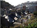
Looking south from Castle Gardens
The view down the Market Street valley from Image The roofs in the foreground are of St Michael's Terrace in Castle Lane, a small cul-de-sac beside the Union Square multistorey car park, which is just behind. Beyond the main town centre valley is Waldon Hill.
Image: © Derek Harper
Taken: 26 Jan 2008
0.02 miles
2
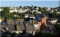
Market Street from Warberry Road West, Torquay
Looking across the Ellacombe valley, with the red block of Stratheden Court at the upper end of Market Street. The row of houses above left of centre is on Castle Road, with Image to its left.
Image: © Derek Harper
Taken: 4 Jul 2010
0.02 miles
3
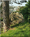
Corner of Castle Gardens, Torquay
Affording a glimpse of town centre building including the Union Square multi-storey car park and Roebuck House.
Image: © Derek Harper
Taken: 17 Apr 2021
0.02 miles
4
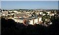
Car park, Torquay
The Union Square Car Park dominates the scene in this early morning view from Warberry Road West. Above it is the greyer mass of the larger Lower Union Lane Car Park. To its left is the striped Roebuck House - see Image
Image: © Derek Harper
Taken: 4 Jul 2010
0.03 miles
5
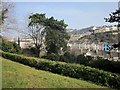
Castle Gardens, Torquay
I visited this little park in the hope of a few spring blooms, but there were none. See also http://www.geograph.org.uk/search.php?i=48043310 .
Image: © Derek Harper
Taken: 12 Mar 2014
0.04 miles
6
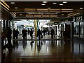
Union Square, Torquay
This is a view looking from the other end of the shopping mall to Image At this end the ceiling is low. This used to be Albert Road back in the early 1970s.
Image: © Derek Harper
Taken: 3 Oct 2008
0.04 miles
7
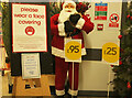
Another Covid Christmas, Torquay
The entrance to the Wilko store in Union Square.
Image: © Derek Harper
Taken: 3 Dec 2021
0.04 miles
8
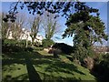
Castle Gardens, Torquay
A modest little park with an interesting outlook; Image was taken from the area shown here. This is actually a lower terrace; the rather larger area is above the little bank with the bushes and extends up to Castle Road, which the buildings front onto.
Image: © Derek Harper
Taken: 26 Jan 2008
0.04 miles
10
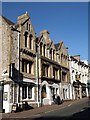
Former police station, Market Street, Torquay
This fine building is hard to find history for - although it's obviously Victorian, and is listed. Apart from the tattoo shop, The Old Cop Shop, a second hand store, occupies part of the building, which has a long frontage onto Castle Lane, and can be seen on the left side of Image Some twenty years ago, there used to be a wondrous second-hand bookshop in the Castle Lane portion.
Image: © Derek Harper
Taken: 26 Jan 2008
0.04 miles