IMAGES TAKEN NEAR TO
Lustleigh, NEWTON ABBOT, TQ13 9SQ
Introduction
This page details the photographs taken nearby to TQ13 9SQ by members of the Geograph project.
The Geograph project started in 2005 with the aim of publishing, organising and preserving representative images for every square kilometre of Great Britain, Ireland and the Isle of Man.

There are currently over 7.5m images from over14,400 individuals and you can help contribute to the project by visiting https://www.geograph.org.uk
Image Map
Images are licensed for reuse under creativecommons.org/licenses/by-sa/2.0
Notes
- Clicking on the map will re-center to the selected point.
- The higher the marker number, the further away the image location is from the centre of the postcode.
Image Listing (70 Images Found)
Images are licensed for reuse under creativecommons.org/licenses/by-sa/2.0
Image
Details
Distance
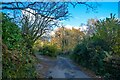
1
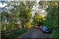
Lustleigh : Country Lane
Looking along a country lane.
Image: © Lewis Clarke
Taken: 21 Nov 2021
0.02 miles
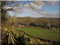
3
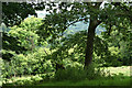
Lustleigh: near Hammerslake
Overlooking the Combe valley above Lustleigh village and featuring an ash tree
Image: © Martin Bodman
Taken: 14 Jul 2008
0.03 miles
4
Lustleigh : Country Lane
Looking along the lane.
Image: © Lewis Clarke
Taken: 21 Nov 2021
0.03 miles
5
Field near Hammerslake
A pair of houses across a meadow, seen from Lustleigh Bridleway 18.
Image: © Derek Harper
Taken: 6 Feb 2013
0.04 miles
6
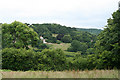
Lustleigh: south of Hammerslake
Looking roughly east across a valley towards Combe and Mapstone
Image: © Martin Bodman
Taken: 14 Jul 2008
0.04 miles
7
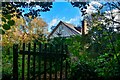
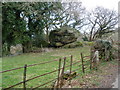
Lustleigh : Loganstones
A house by the footpath.
Image: © Lewis Clarke
Taken: 21 Nov 2021
0.04 miles
8
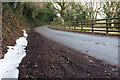
Lane to Hammerslake
A little strip of snow survives by the lane shown in Image]; this looks in the other direction.
Image: © Derek Harper
Taken: 6 Mar 2018
0.05 miles
9
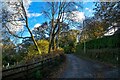
Lustleigh : Country Lane
Looking along a small lane.
Image: © Lewis Clarke
Taken: 21 Nov 2021
0.05 miles
10
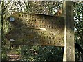
Footpath sign near Hammerslake
At the junction of Lustleigh Bridleways 18 and 19, at the foot of steep woodland below Sharpitor. Some evocative names.
Image: © Derek Harper
Taken: 19 Feb 2012
0.05 miles