
IMAGES TAKEN NEAR TO
Ilsington, NEWTON ABBOT, TQ13 9RT
Introduction
This page details the photographs taken nearby to TQ13 9RT by members of the Geograph project.
The Geograph project started in 2005 with the aim of publishing, organising and preserving representative images for every square kilometre of Great Britain, Ireland and the Isle of Man.

There are currently over 7.5m images from over14,400 individuals and you can help contribute to the project by visiting https://www.geograph.org.uk
Image Map
Images are licensed for reuse under creativecommons.org/licenses/by-sa/2.0
Notes
- Clicking on the map will re-center to the selected point.
- The higher the marker number, the further away the image location is from the centre of the postcode.
Image Listing (7 Images Found)
Images are licensed for reuse under creativecommons.org/licenses/by-sa/2.0
Image
Details
Distance
1
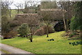
Bagtor Mill
Situated in the valley of the River Lemon.
Image: © Guy Wareham
Taken: 15 Feb 2009
0.11 miles
2

Ilsington: Bagtor Mill
Telephoto view from the lane running down from Birchanger Cross. The mill is now a private house but retains its restored nineteenth century waterwheel
Image: © Martin Bodman
Taken: 19 Aug 2010
0.11 miles
3
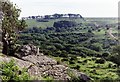
Bag Tor
Bag Tor lies on the very south-east edge of Dartmoor - good flat seating for a picnic. View looking south-west from the tor over the valley of the infant River Sig
Image: © Derek Harper
Taken: Unknown
0.11 miles
4
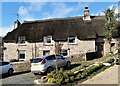
Bagtor Barton
The Farmhouse next to Bagtor House, Islington, Newton Abbot. As well as running Holiday Cottages https://www.bagtorholidaycottages.com/. The family raise Aberdeen Angus Cattle and sell Beef from Farm Wilder https://farmwilder.co.uk/our-farms/bagtor-barton/
Image: © Steve Houldsworth
Taken: 26 Feb 2022
0.19 miles
5
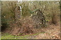
Crownley Parks Tin Mine
The remains of a building that was probably connected with the 19th Century mining activity.
Image: © Guy Wareham
Taken: 28 Feb 2011
0.22 miles
6
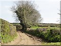
Road or Track?
This is one of those very few occasions when the Ordnance Survey map is misleading. On the map this is shown as a minor road but in reality it is a track, something you should only tackle with an off-road vehicle, or on foot of course. There is no 'Not suitable for Vehicles' sign at this end of the road.
Image: © Tony Atkin
Taken: 6 Apr 2012
0.23 miles
7
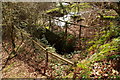
Crownley Parks Tin Mine
A wheelpit that was part of a mine that operated in the middle of the 19th Century.
Image: © Guy Wareham
Taken: 28 Feb 2011
0.23 miles