IMAGES TAKEN NEAR TO
Church Road, NEWTON ABBOT, TQ13 9QF

Introduction

This page details the photographs taken nearby to Church Road, TQ13 9QF by members of the Geograph project.

The Geograph project started in 2005 with the aim of publishing, organising and preserving representative images for every square kilometre of Great Britain, Ireland and the Isle of Man.

There are currently over 7.5m images from over14,400 individuals and you can help contribute to the project by visiting https://www.geograph.org.uk

Image Map


Images are licensed for reuse under creativecommons.org/licenses/by-sa/2.0
Notes
  • Clicking on the map will re-center to the selected point.
  • The higher the marker number, the further away the image location is from the centre of the postcode.

Image Listing (86 Images Found)

Images are licensed for reuse under creativecommons.org/licenses/by-sa/2.0
  • ...
Image
Details
Distance
1
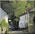
Church Road, Hennock
A detail of the scene in Image, taken from a few metres further north. On the left side of the street is Weavers Hill https://historicengland.org.uk/listing/the-list/list-entry/1334130 .
Image: © Derek Harper Taken: 25 Apr 2019
0.00 miles
2
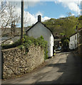
Houses on Church Road
Image: © Roger Cornfoot Taken: 6 Sep 2021
0.01 miles
3
Church Road, Hennock
In the centre on the left side of the street is Weavers Hill https://historicengland.org.uk/listing/the-list/list-entry/1334130 , once the post office. Glimpsed in the background at the end of the street is the thatched Old Vicarage https://historicengland.org.uk/listing/the-list/list-entry/1097382 with Hazelwood Copse above.
Image: © Derek Harper Taken: 25 Apr 2019
0.01 miles
4
Hennock Village
The cottage in the foreground was thatched, and appears in early postcards.
Image: © Chris Andrews Taken: 10 Feb 2013
0.01 miles
5
Rusty old machine in a Hennock garden.
The legend facing the camera reads: Corbett's Plymouth [obscured] / First Prize Grinding [?Mill] / Has Conquered All The [unreadable, obscured]. The legend around the wheel reads: Corbett & Sons Plymouth [unreadable, obscured] ?Grinding Mill, followed by a clockwise pointing arrow.
Image: © Robin Stott Taken: 25 Aug 2011
0.01 miles
6
Church Road, Hennock
Image: © David Gearing Taken: 1 Nov 2012
0.02 miles
7
Village water trough, Hennock
Image: © Guy Wareham Taken: 7 Mar 2014
0.02 miles
8
Lane next to the church in Hennock
Image: © Rob Purvis Taken: 21 Nov 2021
0.02 miles
9
The Palk Arms, Hennock
Image: © Roger Cornfoot Taken: 6 Sep 2021
0.02 miles
10
St Mary's Church, Hennock,
Image: © Roger Cornfoot Taken: 6 Sep 2021
0.02 miles
  • ...