1
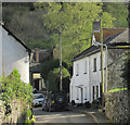
Church Road, Hennock
A detail of the scene in
Image, taken from a few metres further north. On the left side of the street is Weavers Hill https://historicengland.org.uk/listing/the-list/list-entry/1334130 .
Image: © Derek Harper
Taken: 25 Apr 2019
0.01 miles
2
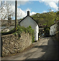
Hennock Village
The cottage in the foreground was thatched, and appears in early postcards.
Image: © Chris Andrews
Taken: 10 Feb 2013
0.01 miles
3
Houses on Church Road
Image: © Roger Cornfoot
Taken: 6 Sep 2021
0.01 miles
4
Village water trough, Hennock
Image: © Guy Wareham
Taken: 7 Mar 2014
0.02 miles
5
Hennock village hall
A surprisingly overpowering building at the north end of the village, at the junction of Church Lane and Bell Lane.
Image: © Robin Stott
Taken: 25 Aug 2011
0.02 miles
6
Communications hub, Hennock
Image: © Robin Stott
Taken: 25 Aug 2011
0.02 miles
7
A survivor of the Great Rock Mine, Hennock
The Great Rock Mine in Hennock was the last working mine in the area. It produced micaceous haematite, used as an ingredient in Rust Proof paint used to paint battleships, tanks, railway bridges etc. It closed in the late 19th century but reopened in 1902, and finally closed in 1969.
Image: © Roger Cornfoot
Taken: 6 Sep 2021
0.02 miles
8
Church Road, Hennock
In the centre on the left side of the street is Weavers Hill https://historicengland.org.uk/listing/the-list/list-entry/1334130 , once the post office. Glimpsed in the background at the end of the street is the thatched Old Vicarage https://historicengland.org.uk/listing/the-list/list-entry/1097382 with Hazelwood Copse above.
Image: © Derek Harper
Taken: 25 Apr 2019
0.02 miles
9
Old Cross base, Hennock
Hennock Cross base, old base by the UC road, in parish of Hennock (Teignbridge District), opposite The Palk Arms PH, East of Vicarage Gatehouse, on granite paving against the wall.
Grade II Listed:-
List Entry Number: 1097384 https://historicengland.org.uk/listing/the-list/list-entry/1097384
Surveyed
Milestone Society National ID: DVTE_HEN
Image: © Alan Rosevear
Taken: 18 Jun 2010
0.02 miles
10
Rusty old machine in a Hennock garden.
The legend facing the camera reads: Corbett's Plymouth [obscured] / First Prize Grinding [?Mill] / Has Conquered All The [unreadable, obscured]. The legend around the wheel reads: Corbett & Sons Plymouth [unreadable, obscured] ?Grinding Mill, followed by a clockwise pointing arrow.
Image: © Robin Stott
Taken: 25 Aug 2011
0.02 miles


