IMAGES TAKEN NEAR TO
Bovey Tracey, NEWTON ABBOT, TQ13 9NZ
Introduction
This page details the photographs taken nearby to TQ13 9NZ by members of the Geograph project.
The Geograph project started in 2005 with the aim of publishing, organising and preserving representative images for every square kilometre of Great Britain, Ireland and the Isle of Man.

There are currently over 7.5m images from over14,400 individuals and you can help contribute to the project by visiting https://www.geograph.org.uk
Image Map
Images are licensed for reuse under creativecommons.org/licenses/by-sa/2.0
Notes
- Clicking on the map will re-center to the selected point.
- The higher the marker number, the further away the image location is from the centre of the postcode.
Image Listing (18 Images Found)
Images are licensed for reuse under creativecommons.org/licenses/by-sa/2.0
Image
Details
Distance
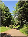
1
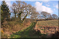
Track near Higher Elsford
Whisper it quietly, but I didn't mean to come this way. An OS map that shows woodland where there is none doesn't help.
Image: © Derek Harper
Taken: 16 Mar 2020
0.16 miles
2
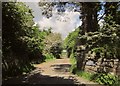
Entrance to Higher Elsford Farm
Image: © Derek Harper
Taken: 5 Jun 2014
0.19 miles
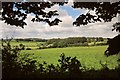
3
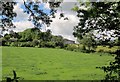
Field, Higher Elsford Farm
The farm is in the background. The view is from beneath an ash at the junction shown in Image
Image: © Derek Harper
Taken: 5 Jun 2014
0.20 miles
4
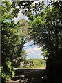
Lane past Higher Elsford Farm
Or the entrance (also shown in Image]), as the lane to Elsford rounds a corner.
Image: © Derek Harper
Taken: 5 Jun 2014
0.21 miles
5
Entrance to Oxonham
From the lane shown in Image
Image: © Derek Harper
Taken: 5 Jun 2014
0.21 miles
6
Countryside near Blackingstone Farm
Image: © Derek Harper
Taken: 5 Jun 2014
0.21 miles
7
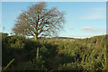
Tree above Trenchford Stream valley
The way seemed fairly clear at the time, but it was around here that I got confused on a return reverse journey a mere three and a half months later - see Image Perhaps impending Covid lockdown got to me.
Image: © Derek Harper
Taken: 3 Dec 2019
0.21 miles
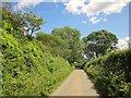
8
Lane, Elsford
Completing its climb, the lane shown in Image passes Oxonham, near Higher Elsford Farm.
Image: © Derek Harper
Taken: 2 May 2009
0.22 miles
9
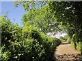
Lane, Elsford
An early June version of the early May scene in Image, with trees fully in leaf, and the leafless one opposite the entrance to Oxonham revealed as an ash.
Image: © Derek Harper
Taken: 5 Jun 2014
0.22 miles
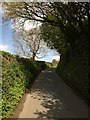
10
Lane to Elsford
Looking down the lane to the corner with the tree shown in Image
Image: © Derek Harper
Taken: 5 Jun 2014
0.22 miles