1
Arnold's hardware store, Bovey Tracey
At the top of Town Hall Place, and one of those places that seems to stock everything. In the window are electric fans and watering cans.
Image: © Derek Harper
Taken: 24 Aug 2009
0.01 miles
2
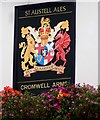
The Cromwell Arms, Bovey Tracey
The Cromwell dates back to the 1600's. In 1646, Cromwell's new model army crossed the Bovey bridge, which had been built a few years earlier, and the battle of Bovey Heath commenced.
Image: © Maigheach-gheal
Taken: 17 Aug 2008
0.01 miles
3
The Bell Inn and Mary Street
A street scene in the centre of Bovey Tracey; Arnolds store sells ironmongery.
Image: © David Smith
Taken: 3 May 2011
0.01 miles
4
Bovey Tracey old fire station and Town Hall
Bovey Tracey old fire station, East Street, Bovey Tracey, Devon, which formed part of the Town Hall building until it was replaced by
Image The colour scheme of the town hall paintwork has changed since the fire station was in use (and for many years after it closed), originally being the more usual fire engine red.
Image: © Kevin Hale
Taken: 28 Feb 2007
0.02 miles
5
Mary Street, Bovey Tracey
Terraced houses leading away from Town Hall Place. In the middle of them is
Image
Image: © Derek Harper
Taken: 29 Mar 2012
0.02 miles
6
Water trough, Bovey Tracey
Children from a local school were involved in the refurbishment of the trough.
Image: © Maigheach-gheal
Taken: 17 Aug 2008
0.02 miles
7
Town Hall Place, Bovey Tracey
This little stretch of street, with the listed Bell Inn https://historicengland.org.uk/listing/the-list/list-entry/1334106 on the left, is also shown in http://www.geograph.org.uk/search.php?i=147497742 . Numbers 12 and 13, beyond the pub is also listed https://historicengland.org.uk/listing/the-list/list-entry/1097411 .
Image: © Derek Harper
Taken: 21 Nov 2021
0.02 miles
8
Sign for the Cromwell Arms
Oliver Cromwell (1599-1658) was a military leader and parliamentarian who became lord protector of England in 1653.
Image: © Maigheach-gheal
Taken: 17 Aug 2008
0.02 miles
9
Bovey Tracey - Mosaic
One of several mosaics in Bovey Tracey depicting local heritage. This one commemorates the Battle of Bovey Heath 1646 [English Civil War].
www.boveytracey.gov.uk
Image: © Colin Smith
Taken: 24 Jul 2021
0.02 miles
10
Bovey Tracey : Town Hall Gargoyle
A gargoyle painted gold on the side of Bovey Tracey Town Hall.
Image: © Lewis Clarke
Taken: 12 Aug 2013
0.02 miles


