
IMAGES TAKEN NEAR TO
Lorn Haven Business Park, NEWTON ABBOT, TQ13 7FF
Introduction
This page details the photographs taken nearby to Lorn Haven Business Park, TQ13 7FF by members of the Geograph project.
The Geograph project started in 2005 with the aim of publishing, organising and preserving representative images for every square kilometre of Great Britain, Ireland and the Isle of Man.

There are currently over 7.5m images from over14,400 individuals and you can help contribute to the project by visiting https://www.geograph.org.uk
Image Map
Images are licensed for reuse under creativecommons.org/licenses/by-sa/2.0
Notes
- Clicking on the map will re-center to the selected point.
- The higher the marker number, the further away the image location is from the centre of the postcode.
Image Listing (26 Images Found)
Images are licensed for reuse under creativecommons.org/licenses/by-sa/2.0
Image
Details
Distance
1
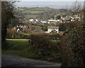
Towards Ashburton from Pitley Cross
Pitley Road drops towards Ashburton past a gateway giving a view over Dolbeare Farm (left) and Buckland View House. Behind are the eastern suburbs of the town, with Bowden Hill in the background.
Image: © Derek Harper
Taken: 10 Mar 2009
0.05 miles

3
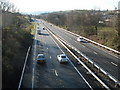
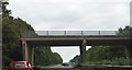
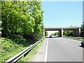
The A38, Devon Expressway, near Ashburton
Image: © Roger Cornfoot
Taken: 3 Dec 2008
0.07 miles
8
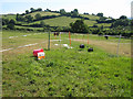
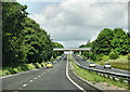
Electric fences forming paddocks
North of Pitley Farm, by the Dolbeare Road, with the slopes of Whistley Hill in the background.
Image: © Robin Stott
Taken: 22 Jun 2010
0.11 miles
10
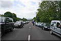
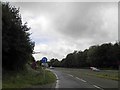
Traffic holdup on the A38
The A38 is the main route out of Cornwall and south west Devon.
This shows the northbound carriageway at Ashburton, looking south, after an accident a couple of miles further north halted traffic for over two hours. After about an hour people started getting out of their cars and walked about, chatted to other drivers, exercised their dogs, supervised curious children and even sat on the central reservation barrier with a book. If we'd been there much longer I reckoned people would have got out their beach chairs,tables and camping stoves and made a cup of tea!
On a more serious note: you can see everyone moved to the edge of the lanes to allow emergency vehicles through but only one police car appeared. The rest used the B3352 through Ashburton to access the accident site. Thankfully the driver of the only car involved wasn't seriously injured.
Image: © Kate Jewell
Taken: 22 May 2011
0.12 miles