IMAGES TAKEN NEAR TO
Colway Lane, NEWTON ABBOT, TQ13 0LA

Introduction

This page details the photographs taken nearby to Colway Lane, TQ13 0LA by members of the Geograph project.

The Geograph project started in 2005 with the aim of publishing, organising and preserving representative images for every square kilometre of Great Britain, Ireland and the Isle of Man.

There are currently over 7.5m images from over14,400 individuals and you can help contribute to the project by visiting https://www.geograph.org.uk

Image Map


Images are licensed for reuse under creativecommons.org/licenses/by-sa/2.0
Notes
  • Clicking on the map will re-center to the selected point.
  • The higher the marker number, the further away the image location is from the centre of the postcode.

Image Listing (59 Images Found)

Images are licensed for reuse under creativecommons.org/licenses/by-sa/2.0
  • ...
Image
Details
Distance
1
Street scene, Chudleigh
A quiet street of white washed terraced houses.
Image: © Maigheach-gheal Taken: 17 Aug 2008
0.06 miles
2
George V postbox, Chudleigh
Located in the wall of Culver House.
Image: © Maigheach-gheal Taken: 17 Aug 2008
0.07 miles
3
Old Exeter Road leaves Chudleigh
Image: © Sarah Charlesworth Taken: 29 Oct 2009
0.08 miles
4
Old barn on the outskirts of Chudleigh
Image: © Sarah Charlesworth Taken: 29 Oct 2009
0.08 miles
5
New Exeter Street, Chudleigh
Image: © Roger Cornfoot Taken: 20 Nov 2008
0.13 miles
6
Houses on Old Exeter Street, Chudleigh
Some distinctive facades on the street shown in Image The blue-washed house, which is listed, is described at http://www.imagesofengland.org.uk/Details/Default.aspx?id=85330&mode=adv .
Image: © Derek Harper Taken: 16 Mar 2009
0.13 miles
7
Bottle Bridge Hill
An earlier road to Exeter leaves Chudleigh by crossing this valley (a tributary of the Kate Brook) at Bottle Bridge. On the left side of the far hill, Heathfieldlake Hill, is Image
Image: © Derek Harper Taken: 16 Mar 2009
0.14 miles
8
Footpath on the outskirts of Chudleigh
Image: © Sarah Charlesworth Taken: 29 Oct 2009
0.15 miles
9
Bottle Bridge
According to: http://www.chudleighhistorygroup.com/toll-houses.html , the name "Bottle" may be a corruption of "Buddle", and two origins are suggested for this. The site prefers "a meaning of buddle as being a spring of water bursting through the road"
Image: © David Smith Taken: 8 Sep 2011
0.15 miles
10
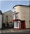
Chapel and house, Chudleigh
In the shadow is the United Reformed church, dating from 1830, with Italianate windows and an oculus in the gable. The ground floor windows of the house on the corner of Old Exeter Street (foreground) and Woodway Street, reaching almost to the pavement, suggest it was formerly a shop.
Image: © Derek Harper Taken: 16 Mar 2009
0.16 miles
  • ...