
IMAGES TAKEN NEAR TO
Lower Erith Road, TORQUAY, TQ1 2PR
Introduction
This page details the photographs taken nearby to Lower Erith Road, TQ1 2PR by members of the Geograph project.
The Geograph project started in 2005 with the aim of publishing, organising and preserving representative images for every square kilometre of Great Britain, Ireland and the Isle of Man.

There are currently over 7.5m images from over14,400 individuals and you can help contribute to the project by visiting https://www.geograph.org.uk
Image Map
Images are licensed for reuse under creativecommons.org/licenses/by-sa/2.0
Notes
- Clicking on the map will re-center to the selected point.
- The higher the marker number, the further away the image location is from the centre of the postcode.
Image Listing (92 Images Found)
Images are licensed for reuse under creativecommons.org/licenses/by-sa/2.0
Image
Details
Distance
1
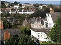
Houses on north slopes of Lincombes
A view of houses from Ridgway Road, which runs along the contour on the north side of Lincombe Hill, and is here merely a track.
The impressive Victorian limestone building, Erith House, is a residential home. The gleaming terrace beyond is Wellswood Park, straddling the gridline between SX9264 and SX9364. Beyond are villas on the eastern slopes of Warberry Hill.
Image: © Derek Harper
Taken: 7 Mar 2008
0.01 miles
2
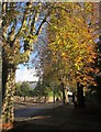
Babbacombe Road, Torquay
The junction with Lower Warberry Road (left), with autumnal trees and a bus stop.
Image: © Derek Harper
Taken: 1 Nov 2012
0.06 miles
3
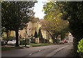
Babbacombe Road, Torquay
Looking down the A379 from the junction with Lower Warberry Road (see Image]). I think most of the villas along the tree-lined road are now divided into flats.
Image: © Derek Harper
Taken: 1 Nov 2012
0.06 miles
4
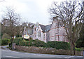
Erith House Residential Home
This imposing building on the corner of Lower Erith Road was built in 1860/1861 to accommodate gentlewomen suffering from chest ailments. It is now a private care home for 20 residents.
Image: © Richard Dorrell
Taken: 27 Mar 2010
0.06 miles
5
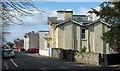
Higher Erith Road, Torquay
Large buildings sub-divided into flats on the north side of Lincombe Hill.
Image: © Derek Harper
Taken: 11 Mar 2016
0.06 miles
6
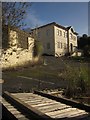
Lansdowne Hotel, Torquay
The hotel closed six years ago. Last year it was damaged by a fire that police considered arson. The previous year it was raided by scrap-metal thieves, who were caught.
Image: © Derek Harper
Taken: 15 Feb 2013
0.07 miles
7
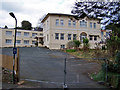
Awaiting redevelopment?
This is the Lansdowne Hotel in Old Torwood Road, Torquay. It is clearly currently closed, and has the look of a building either awaiting significant refurbishment, or maybe demolition and redevelopment.
Update: The hotel was demolished in 2015, and a block of flats built in its place - see: Image
Image: © Richard Dorrell
Taken: 27 Mar 2010
0.07 miles
8
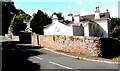
Acadia Road, Torquay
Looking south from the A379 Babbacombe Road.
I wondered if the name of the road, Acadia, shown on the wall, is often misspelt Acacia or Arcadia...
Image: © Jaggery
Taken: 6 Jul 2014
0.08 miles
10
Sunset Villa
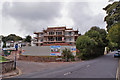
On the site of the former Lansdowne Hotel, at the junction of Old Torwood Road and Babbacombe Road, a new four storey block of flats is under construction. The block is named Sunset Villa. The new flats are priced from £250,000 to £350,000, and most are already sold.
Former building on this site - Lansdowne Hotel - Image
Image: © Richard Dorrell
Taken: 15 Sep 2015
0.08 miles