IMAGES TAKEN NEAR TO
Park Hill Road, TORQUAY, TQ1 2DY

Introduction

This page details the photographs taken nearby to Park Hill Road, TQ1 2DY by members of the Geograph project.

The Geograph project started in 2005 with the aim of publishing, organising and preserving representative images for every square kilometre of Great Britain, Ireland and the Isle of Man.

There are currently over 7.5m images from over14,400 individuals and you can help contribute to the project by visiting https://www.geograph.org.uk

Image Map


Images are licensed for reuse under creativecommons.org/licenses/by-sa/2.0
Notes
  • Clicking on the map will re-center to the selected point.
  • The higher the marker number, the further away the image location is from the centre of the postcode.

Image Listing (299 Images Found)

Images are licensed for reuse under creativecommons.org/licenses/by-sa/2.0
  • ...
Image
Details
Distance
1
Devonshire Hotel, Torquay
Seen across Parkhill Road from footpath TQ 159. The 1840s villa, in Italianate style, is listed and described at https://historicengland.org.uk/listing/the-list/list-entry/1292110 .
Image: © Derek Harper Taken: 29 Oct 2018
0.02 miles
2
Georgian House, Parkhill Road
Just the west wing of the listed building https://historicengland.org.uk/listing/the-list/list-entry/1218172?section=official-list-entry is clearly visible. Now an assisted living facility.
Image: © Derek Harper Taken: 2 Sep 2022
0.03 miles
3
Notices, Daddyhole Road
Jubilee flags obscure much of the plethora of notices on these gates, but the specific nature of "DO NOT PARK WITH ANY PART OF YOUR CAR OVER THE WHITE LINE" interested me.
Image: © Derek Harper Taken: 1 Jul 2022
0.03 miles
4
Coach, Parkhill Road, Torquay
This Volvo B11R in the livery of Robinsons Coach Holidays is now part of Daish's Robinsons, and the address it carries is the Devonshire Hotel Image, sitting to the right of the camera.
Image: © Derek Harper Taken: 1 Jul 2022
0.04 miles
5
Signs, Daddyhole Road, Torquay
Old blue and white tiled street name and direction above a more modern sign.
Image: © Derek Harper Taken: 18 Mar 2013
0.04 miles
6
Junction of Daddyhole Road and St Mark's Road
Looking right from where Image] was taken.
Image: © Derek Harper Taken: 31 Jul 2018
0.05 miles
7
Junction on Daddyhole Road
A reverse view of Image, which attempts to explain the road situation here. Daddyhole Road branches right up to Daddyhole Plain; the road with the right of way continues as St Mark's Road.
Image: © Derek Harper Taken: 25 Sep 2020
0.05 miles
8
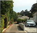
Entrance drive off Parkhill Road
To a house otherwise enclosed behind a square of roads. In the background is The Little Theatre, formerly St Mark's church, shown in Image
Image: © Derek Harper Taken: 2 Sep 2022
0.05 miles
9
A path and a stone on Parkhill Road
The footpath leads to St John's Wood and thence to Vanehill Road. Beside is a stone with the initials 'AJ' and a much smaller 'HB' - presumably a boundary marker of some sort. See Image] for a wider view.
Image: © Neil Owen Taken: 16 Sep 2022
0.05 miles
10
Parkhill Road
A steep part of Torquay, with a footpath entrance and a stone set into the wall. See Image] for a better look.
Image: © Neil Owen Taken: 16 Sep 2022
0.05 miles
  • ...