IMAGES TAKEN NEAR TO
Ridgeway Road, NEWTON ABBOT, TQ12 4LS
Introduction
This page details the photographs taken nearby to Ridgeway Road, TQ12 4LS by members of the Geograph project.
The Geograph project started in 2005 with the aim of publishing, organising and preserving representative images for every square kilometre of Great Britain, Ireland and the Isle of Man.

There are currently over 7.5m images from over14,400 individuals and you can help contribute to the project by visiting https://www.geograph.org.uk
Image Map
Images are licensed for reuse under creativecommons.org/licenses/by-sa/2.0
Notes
- Clicking on the map will re-center to the selected point.
- The higher the marker number, the further away the image location is from the centre of the postcode.
Image Listing (64 Images Found)
Images are licensed for reuse under creativecommons.org/licenses/by-sa/2.0
Image
Details
Distance
1
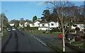
Aller Brake Road
At its junction with Oak Tree Drive (right).
Image: © Derek Harper
Taken: 21 Feb 2016
0.08 miles
2
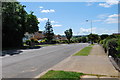
Aller Brake Road
A suburban road leading from Milber Woods, behind the photographer, towards the Aller valley.
Image: © Paul Hutchinson
Taken: 15 Jun 2009
0.13 miles
3
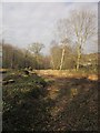
St Marychurch Road, Milber
Showing the cleared area on the northeast side of the road in preparation for constructing the junction with Aller Brake Road, as illustrated in Image
Image: © Derek Harper
Taken: 16 Feb 2013
0.17 miles
4
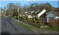
Aller Brake Road
From the junction with Birch Road (right). The top of the road was for many years cut off from St Marychurch Road; as a result of the construction of the South Devon Highway, the connection has been reopened, but only for vehicles travelling to and from Newton Abbot. Immediately before the junction, the road crosses a belt of woodland; Penninn Plantation to the left, and Ben Stedhams Wood to the right.
Image: © Derek Harper
Taken: 21 Feb 2016
0.18 miles
5
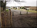
Aller Brake Road
Looking in the other direction from the side of the oak tree seen in Image] and Image Currently there is no vehicular access from St Marychurch Road onto Aller Brake Road, but restricted access is to be created.
Image: © Derek Harper
Taken: 16 Feb 2013
0.18 miles
6
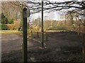
Future road junction, Aller Brake Road
Aller Brake Road is currently a cul-de-sac, but limited vehicle access onto St Marychurch Road, 15 metres away to the right, will be constructed in the next year or two. The footpath sign indicates Newton Abbot Footpath 39 up the side of Ben Stedham's Wood.
Image: © Derek Harper
Taken: 16 Feb 2013
0.19 miles
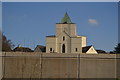
8
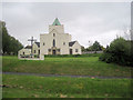
St Luke The Evangelist church
Viewed from Torquay Road. entrance to church in Laburnum Road
Image: © John Firth
Taken: 14 May 2010
0.19 miles
9
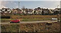
A380 at Milber
A view from the railway line revealed by the removal of trees in preparation for the new link road construction. The A380 will be dualled here,and this means shaving a bit off the gardens in the background as well as appropriating the grass bank.
Image: © Derek Harper
Taken: 20 Mar 2013
0.20 miles