
IMAGES TAKEN NEAR TO
St. Marychurch Road, NEWTON ABBOT, TQ12 4AP
Introduction
This page details the photographs taken nearby to St. Marychurch Road, TQ12 4AP by members of the Geograph project.
The Geograph project started in 2005 with the aim of publishing, organising and preserving representative images for every square kilometre of Great Britain, Ireland and the Isle of Man.

There are currently over 7.5m images from over14,400 individuals and you can help contribute to the project by visiting https://www.geograph.org.uk
Image Map
Images are licensed for reuse under creativecommons.org/licenses/by-sa/2.0
Notes
- Clicking on the map will re-center to the selected point.
- The higher the marker number, the further away the image location is from the centre of the postcode.
Image Listing (111 Images Found)
Images are licensed for reuse under creativecommons.org/licenses/by-sa/2.0
Image
Details
Distance
1
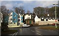
New housing, St Marychurch Road, Newton Abbot
Flats opposite the junction with Pinewood Road. Ashwood Court, the older development on the right is on the site of a former coach firm, a heritage reflected in the little stable-like turret. The structure with a green door is an electricity sub-station. On the left, sporting a vivid blue, is "The Sand Martins".
Image: © Derek Harper
Taken: 23 Feb 2010
0.02 miles
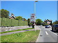
3
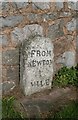
Old Milestone by Shaldon Road, Newton Abbot Parish
Carved stone post by UC road, in parish of NEWTON ABBOT (TEIGNBRIDGE District), East of Penn Inn roundabout, Shaldon Road, 10m from traffic lights at Queensway junction, back to a stone wall on small paved area, on North side of road. Newton granite stone, erected by the Dartmouth, Torquay & Shaldon turnpike trust in the 19th century.
Inscription reads:- : FROM / NEWTON / 1 / MILE :
Milestone Society National ID: DV_NASH01
Image: © Alan Rosevear
Taken: 7 Mar 2012
0.06 miles
4
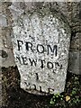
Old Milestone by B3195 above Penn Inn roundabout, Shaldon Road, 10m from traffic lights at Queensway junction
The Milestone is located back to a stone wall on small paved area on the north side of the road. Parish of Newton Abbot (Teignbridge District). Carved stone post, Newton granite stone design, erected by the Dartmouth, Torquay & Shaldon turnpike trust in the 19th Century, chips on top edge; eroded.
An earlier photograph can be found here: https://www.geograph.org.uk/photo/6045285
Inscription reads:-
FROM / NEWTON / 1 / MILE /
Milestone Society National ID: DV_NASH01
Image: © Tim Jenkinson
Taken: 6 Nov 2022
0.06 miles
5
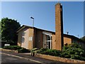
Mormon Chapel, Newton Abbot
The Church of Jesus Christ of Latter-day Saints, on St Marychurch Road, this part of which is a cul-de-sac created when access to Penn Inn roundabout from the through road was diverted via Shaldon Road.
Image: © Derek Harper
Taken: 4 Jun 2008
0.06 miles
6
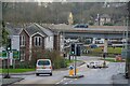
Newton Abbot : Shaldon Road
Looking along the road.
Image: © Lewis Clarke
Taken: 31 Dec 2021
0.07 miles
7
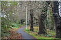
Newton Abbot : Shaldon Road
A footpath alongside Shaldon Road.
Image: © Lewis Clarke
Taken: 31 Dec 2021
0.10 miles

9
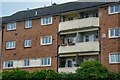
Newton Abbot : Flats
Flats in Newton Abbot.
Image: © Lewis Clarke
Taken: 31 Dec 2021
0.10 miles
10
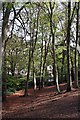
Milber Wood
Milber Wood is a narrow strip of mature woodland running through the heart of this urban landscape.
Image: © Tony Atkin
Taken: 23 Apr 2009
0.11 miles