
IMAGES TAKEN NEAR TO
Market Close, BUCKFASTLEIGH, TQ11 0QA
Introduction
This page details the photographs taken nearby to Market Close, TQ11 0QA by members of the Geograph project.
The Geograph project started in 2005 with the aim of publishing, organising and preserving representative images for every square kilometre of Great Britain, Ireland and the Isle of Man.

There are currently over 7.5m images from over14,400 individuals and you can help contribute to the project by visiting https://www.geograph.org.uk
Image Map
Images are licensed for reuse under creativecommons.org/licenses/by-sa/2.0
Notes
- Clicking on the map will re-center to the selected point.
- The higher the marker number, the further away the image location is from the centre of the postcode.
Image Listing (72 Images Found)
Images are licensed for reuse under creativecommons.org/licenses/by-sa/2.0
Image
Details
Distance
1
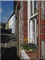
Jordan Street, Buckfastleigh
A spring window box on a terrace of houses at the west end of town.
Image: © Derek Harper
Taken: 14 Mar 2013
0.04 miles
2
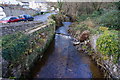
River Mardle, Buckfastleigh
Looking upstream from Market Street. The road on the left is Market Close.
Image: © jeff collins
Taken: 10 Dec 2014
0.05 miles
3
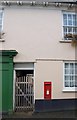
Victorian postbox, Buckfastleigh
This box is in Market Street, a little way up from Higher Town Bridge over the Mardle.
Image: © Derek Harper
Taken: 16 Jan 2009
0.05 miles
4
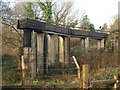
Launder, Buckfastleigh
Seen from Bridge Street, just above Higher Town Bridge over the River Mardle. Marked on the maps as an aqueduct, this carried water from the Old Mill Leat which powered the Town Corn Mill (which occupied this spot) and Churchwards/Sherwell Woollen Mill (which was further west).
Image: © Derek Harper
Taken: 16 Jan 2009
0.05 miles
5
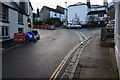
Crossroads, Buckfastleigh
With the usual roadworks in progress.
Image: © jeff collins
Taken: 10 Dec 2014
0.06 miles
8
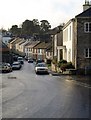
Bridge Street, Buckfastleigh
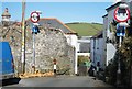
From beside the Sun Inn at the far end of the view in Image, looking past the junction with Silver Street down to the Higher Town Bridge over the River Mardle. The houses rising beyond are on Market Street.
"On the corner of Bridge Street and Silver Street, built against 9 Bridge Street, is what appears to be a limestone bench. Whether designed as such it certainly has that potential use and is an interesting incidental feature." http://www.dartmoor-npa.gov.uk/li-buckfastleigh.pdf
Image: © Derek Harper
Taken: 16 Jan 2009
0.08 miles
9
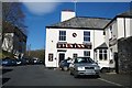
Heading up Church Street
Skirting around the centre of Buckfastleigh.
Image: © Fernweh
Taken: 15 Mar 2014
0.09 miles
10
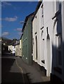
Chapel Street, Buckfastleigh
Terraced houses along the western end of the street.
Image: © Derek Harper
Taken: 14 Mar 2013
0.09 miles