
IMAGES TAKEN NEAR TO
Plymouth Road, BUCKFASTLEIGH, TQ11 0FB
Introduction
This page details the photographs taken nearby to Plymouth Road, TQ11 0FB by members of the Geograph project.
The Geograph project started in 2005 with the aim of publishing, organising and preserving representative images for every square kilometre of Great Britain, Ireland and the Isle of Man.

There are currently over 7.5m images from over14,400 individuals and you can help contribute to the project by visiting https://www.geograph.org.uk
Image Map
Images are licensed for reuse under creativecommons.org/licenses/by-sa/2.0
Notes
- Clicking on the map will re-center to the selected point.
- The higher the marker number, the further away the image location is from the centre of the postcode.
Image Listing (157 Images Found)
Images are licensed for reuse under creativecommons.org/licenses/by-sa/2.0
Image
Details
Distance
1
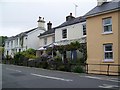
Housing on Plymouth Road, Buckfastleigh
A variety of housing styles on this residential street.
Image: © Maigheach-gheal
Taken: 13 May 2009
0.01 miles
2
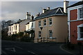
Plymouth Road, Buckfastleigh
Looking from the forecourt of St Lukes Church to some attractive Victorian villas in Plymouth Road at the junction with Bossell Road. Behind the railings in front of the houses runs a clear stream, it's not visible in this image as it is some 4 feet below the road level and is culverted on either side of this stretch, no doubt it eventually runs into the Mardle and then the River Dart. The stream is the Town Mill Leat, and can be seen in front of the cottages in Image - with thanks to Derek Harper !
Image: © Adrian Platt
Taken: 5 Jan 2009
0.01 miles
3
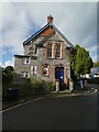
Buckfastleigh Town Hall
In the gable the date is 1887 (final digit unclear) between V and R, and the text below reads: Buckfastleigh Hall and Institute
Image: © David Smith
Taken: 19 Oct 2019
0.01 miles
4
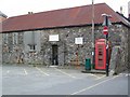
Telephone box, Buckfastleigh
K6 style telephone box on Plymouth Road.
Image: © Maigheach-gheal
Taken: 13 May 2009
0.01 miles
5
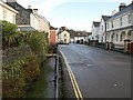
Town Mill Leat on Plymouth Road, Buckfastleigh
"At some point, possibly early in the development of the settlement,
the Town Mill Leat was formed to take water from the Dean Burn some
way to the south west. This brought water into the heart of Lower Town
and remains a distinctive feature today." http://www.dartmoor-npa.gov.uk/pages_9-19_from_buckfastleigh-2.pdf
Image: © Derek Harper
Taken: 16 Jan 2009
0.02 miles
7
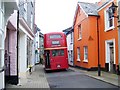
Red bus, Buckfastleigh
The bus is used to ferry people from the Buckfast Station, to the abbey and into Buckfastleigh town centre.
Image: © Maigheach-gheal
Taken: 13 May 2009
0.03 miles
9
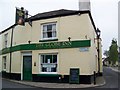
The Globe Inn, Bucklastleigh
A traditional public house known for its good food.
Image: © Maigheach-gheal
Taken: 13 May 2009
0.03 miles
10
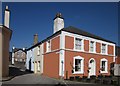
Bossell Road, Buckfastleigh
Showing the house on the right of Image The one on the left of both photos is listed.
Image: © Derek Harper
Taken: 14 Mar 2013
0.03 miles