
IMAGES TAKEN NEAR TO
Fore Street, BUCKFASTLEIGH, TQ11 0AA
Introduction
This page details the photographs taken nearby to Fore Street, TQ11 0AA by members of the Geograph project.
The Geograph project started in 2005 with the aim of publishing, organising and preserving representative images for every square kilometre of Great Britain, Ireland and the Isle of Man.

There are currently over 7.5m images from over14,400 individuals and you can help contribute to the project by visiting https://www.geograph.org.uk
Image Map
Images are licensed for reuse under creativecommons.org/licenses/by-sa/2.0
Notes
- Clicking on the map will re-center to the selected point.
- The higher the marker number, the further away the image location is from the centre of the postcode.
Image Listing (158 Images Found)
Images are licensed for reuse under creativecommons.org/licenses/by-sa/2.0
Image
Details
Distance
1
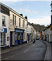
Fore Street, Buckfastleigh
The narrow main street is now one way for traffic. Early C19 frontages often hide older buildings. The street is dropping down a ridge between the River Mardle (left) and the Dean Burn, and burgage plots, many occupied by cottages, are set at right angles to the street on both sides, descending to these streams.
Image: © Derek Harper
Taken: 16 Jan 2009
0.01 miles
2
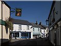
Fore Street, Buckfastleigh
From Plymouth Road, with the Globe Inn on the left.
Image: © Derek Harper
Taken: 14 Mar 2013
0.02 miles
3
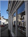
Reflection of Fore Street, Buckfastleigh
In the window of a listed building http://list.english-heritage.org.uk/resultsingle.aspx?uid=1292835&searchtype=mapsearch .
Image: © Derek Harper
Taken: 14 Mar 2013
0.02 miles
4
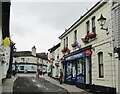
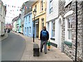
Buckfastleigh - Fore Street
A market and mill town with many historic buildings on its main street.
Image: © Colin Smith
Taken: 25 Jul 2021
0.02 miles
6
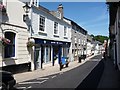
North side of Fore Street, Buckfastleigh
On a sunny afternoon, the shops on the north side of Fore Street are in bright sunshine, those on the south side in deep shade.
Image: © Christine Johnstone
Taken: 21 Jun 2010
0.02 miles
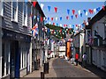
8
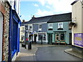
Junction of Chapel Street, Fore Street and Plymouth Road, Buckfastleigh
Image: © Ruth Sharville
Taken: 9 Nov 2013
0.02 miles
9
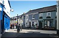
Centre of Buckfastleigh
Must be a devil for delivery trucks.
Image: © Fernweh
Taken: 15 Mar 2014
0.02 miles
10
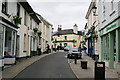
Fore Street Buckfastleigh
There are some shops surviving here in the town centre but it is not the bustling street it once was.
Image: © Tony Atkin
Taken: 29 Aug 2008
0.02 miles