IMAGES TAKEN NEAR TO
Ashcombe Drive, EDENBRIDGE, TN8 6JY
Introduction
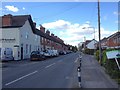
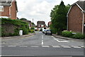
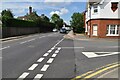
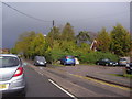
This page details the photographs taken nearby to Ashcombe Drive, TN8 6JY by members of the Geograph project.
The Geograph project started in 2005 with the aim of publishing, organising and preserving representative images for every square kilometre of Great Britain, Ireland and the Isle of Man.

There are currently over 7.5m images from over14,400 individuals and you can help contribute to the project by visiting https://www.geograph.org.uk
Image Map (Loading...)


Getting Data...Please wait
Leaflet Map data © OpenStreetMap
Images are licensed for reuse under creativecommons.org/licenses/by-sa/2.0
Notes
- Clicking on the map will re-center to the selected point.
- The higher the marker number, the further away the image location is from the centre of the postcode.
Image Listing (111 Images Found)
Images are licensed for reuse under creativecommons.org/licenses/by-sa/2.0
Image
Details
Distance

4
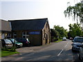
Baptist Church - Edenbridge
The small Baptist church is situated in Hilder's Lane in the Marlpit Hill area of the fast growing Edenbridge town.
Image: © Jean Barrow
Taken: 10 May 2006
0.06 miles

10
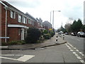
Swan Lane, Edenbridge
The Swan pub car park is on the right
Image: © David Howard
Taken: 22 Apr 2012
0.09 miles