IMAGES TAKEN NEAR TO
Station Road, CROWBOROUGH, TN6 3HN
Introduction
This page details the photographs taken nearby to Station Road, TN6 3HN by members of the Geograph project.
The Geograph project started in 2005 with the aim of publishing, organising and preserving representative images for every square kilometre of Great Britain, Ireland and the Isle of Man.

There are currently over 7.5m images from over14,400 individuals and you can help contribute to the project by visiting https://www.geograph.org.uk
Image Map
Images are licensed for reuse under creativecommons.org/licenses/by-sa/2.0
Notes
- Clicking on the map will re-center to the selected point.
- The higher the marker number, the further away the image location is from the centre of the postcode.
Image Listing (108 Images Found)
Images are licensed for reuse under creativecommons.org/licenses/by-sa/2.0
Image
Details
Distance
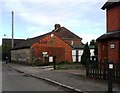
1
Entrance to Rotherfield Millennium Green
Note to OS:- on their Explorer map they have only one 'n' in millennium.
Image: © Dave Spicer
Taken: 28 Aug 2010
0.03 miles
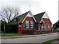

9
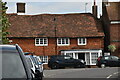
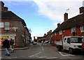
The Old Bakery
Grade II listed. https://historicengland.org.uk/listing/the-list/list-entry/1194084
Image: © N Chadwick
Taken: 8 Sep 2020
0.09 miles