IMAGES TAKEN NEAR TO
Watson Way, CROWBOROUGH, TN6 2FP
Introduction
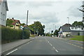
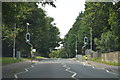
This page details the photographs taken nearby to Watson Way, TN6 2FP by members of the Geograph project.
The Geograph project started in 2005 with the aim of publishing, organising and preserving representative images for every square kilometre of Great Britain, Ireland and the Isle of Man.

There are currently over 7.5m images from over14,400 individuals and you can help contribute to the project by visiting https://www.geograph.org.uk
Image Map
Images are licensed for reuse under creativecommons.org/licenses/by-sa/2.0
Notes
- Clicking on the map will re-center to the selected point.
- The higher the marker number, the further away the image location is from the centre of the postcode.
Image Listing (66 Images Found)
Images are licensed for reuse under creativecommons.org/licenses/by-sa/2.0
Image
Details
Distance
4
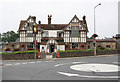
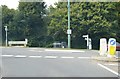
The White Hart, Crowborough Hill / Church Road, TN6
Image: © Mike Quinn
Taken: 22 Aug 2012
0.08 miles
9
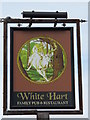
Sign for The White Hart, Crowborough Hill / Church Road, TN6
See Image
Image: © Mike Quinn
Taken: 22 Aug 2012
0.09 miles
10
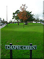
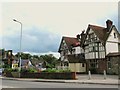
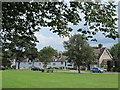
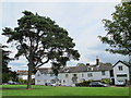
Chapel Green
Small green laid around the 1750s near the church.
Image: © Simon Carey
Taken: 20 Jan 2007
0.09 miles