IMAGES TAKEN NEAR TO
Burdett Road, CROWBOROUGH, TN6 2EN
Introduction
This page details the photographs taken nearby to Burdett Road, TN6 2EN by members of the Geograph project.
The Geograph project started in 2005 with the aim of publishing, organising and preserving representative images for every square kilometre of Great Britain, Ireland and the Isle of Man.

There are currently over 7.5m images from over14,400 individuals and you can help contribute to the project by visiting https://www.geograph.org.uk
Image Map
Images are licensed for reuse under creativecommons.org/licenses/by-sa/2.0
Notes
- Clicking on the map will re-center to the selected point.
- The higher the marker number, the further away the image location is from the centre of the postcode.
Image Listing (81 Images Found)
Images are licensed for reuse under creativecommons.org/licenses/by-sa/2.0
Image
Details
Distance
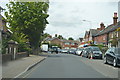
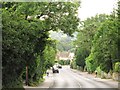
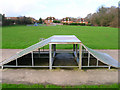
2
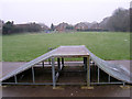
Recreation Ground, Jarvis Brook
Same shot as Image but with added flurries of snow.
Image: © Simon Carey
Taken: 3 Jan 2008
0.09 miles
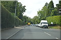
3
Recreation Ground, Jarvis Brook
The houses to the north are in Burdett Road.
Image: © Simon Carey
Taken: 20 Jan 2007
0.10 miles
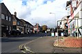
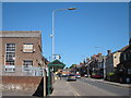
4
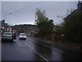
Crowborough Hill, Jarvis Brook
This is the small shopping street with the station on the right
Image: © David Howard
Taken: 22 Apr 2012
0.10 miles