IMAGES TAKEN NEAR TO
St. Johns Road, CROWBOROUGH, TN6 1RZ
Introduction
This page details the photographs taken nearby to St. Johns Road, TN6 1RZ by members of the Geograph project.
The Geograph project started in 2005 with the aim of publishing, organising and preserving representative images for every square kilometre of Great Britain, Ireland and the Isle of Man.

There are currently over 7.5m images from over14,400 individuals and you can help contribute to the project by visiting https://www.geograph.org.uk
Image Map
Images are licensed for reuse under creativecommons.org/licenses/by-sa/2.0
Notes
- Clicking on the map will re-center to the selected point.
- The higher the marker number, the further away the image location is from the centre of the postcode.
Image Listing (53 Images Found)
Images are licensed for reuse under creativecommons.org/licenses/by-sa/2.0
Image
Details
Distance
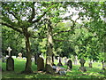
1
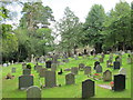
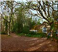
The churchyard of St. John The Evangelist. St. John's Road, TN6 (4)
Image: © Mike Quinn
Taken: 22 Aug 2012
0.04 miles
2
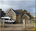
St John's Primary School, School Lane, St John's, Crowborough
The old part of the school dates from 1840 originally as a church school for nearby St John's. There is a newer block out of shot to the right.
Image: © Simon Carey
Taken: 21 Nov 2021
0.04 miles
3
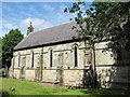
The Church of St. John The Evangelist. St. John's Road, TN6 (2)
See also Image
Image: © Mike Quinn
Taken: 22 Aug 2012
0.05 miles
4
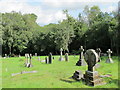
The churchyard of St. John The Evangelist. St. John's Road, TN6 (3)
See Image
Image: © Mike Quinn
Taken: 22 Aug 2012
0.05 miles
5
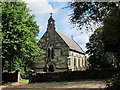
The Church of St. John The Evangelist. St. John's Road, TN6
Image: © Mike Quinn
Taken: 22 Aug 2012
0.05 miles
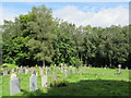
6
The churchyard of St. John The Evangelist. St. John's Road, TN6
See Image
Image: © Mike Quinn
Taken: 22 Aug 2012
0.06 miles
7
The churchyard of St. John The Evangelist. St. John's Road, TN6 (2)
See Image
Image: © Mike Quinn
Taken: 22 Aug 2012
0.07 miles
8
Fourways, School Lane, St John's, Crowborough
Built in the first decade of the 20th century.
Image: © Simon Carey
Taken: 21 Nov 2021
0.07 miles
9
The Reading Room, School Lane, St John's, Crowborough
Built in the late 19th century as a reading room now home to St John's Preschool Nursery.
Image: © Simon Carey
Taken: 21 Nov 2021
0.10 miles
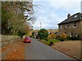
10
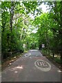
St John's Road
Heading westwards to Mardens Hill. The current bounds of Ashdown Forest start here though in the past they were further eastwards but have been encroached by the spread of Crowborough.
Image: © Simon Carey
Taken: 18 Jun 2022
0.10 miles