IMAGES TAKEN NEAR TO
Courtlands Place, CROWBOROUGH, TN6 1JJ
Introduction
This page details the photographs taken nearby to Courtlands Place, TN6 1JJ by members of the Geograph project.
The Geograph project started in 2005 with the aim of publishing, organising and preserving representative images for every square kilometre of Great Britain, Ireland and the Isle of Man.

There are currently over 7.5m images from over14,400 individuals and you can help contribute to the project by visiting https://www.geograph.org.uk
Image Map
Images are licensed for reuse under creativecommons.org/licenses/by-sa/2.0
Notes
- Clicking on the map will re-center to the selected point.
- The higher the marker number, the further away the image location is from the centre of the postcode.
Image Listing (18 Images Found)
Images are licensed for reuse under creativecommons.org/licenses/by-sa/2.0
Image
Details
Distance
1
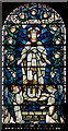
All Saints, Crowborough - Stained glass window
Image: © John Salmon
Taken: 28 Jun 2011
0.06 miles
2
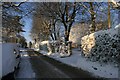
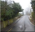
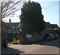
Church Road, Crowborough
View up (west) Church Road, Crowborough
Image: © Geoff Cooper
Taken: 18 Dec 2009
0.06 miles
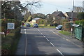
7
Crowborough War Memorial Hospital
Opened around 1911 as a cottage hospital and used extensively during the First World War changing its name as a reminder to that period around 1920. The small hospital has fought two attempts to close its maternity unit as well as utilising its charitable status to half fund an upgrade when threatened with closure in 1990s.
Image: © Simon Carey
Taken: 2 Oct 2015
0.17 miles
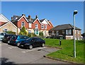
8
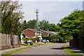
Woodside, Crowborough, Sussex
The distant tower stands beside a covered reservoir.
Image: © Peter Trimming
Taken: 26 Apr 2011
0.18 miles
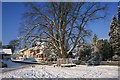
9
Harecombe Manor, Southview Road, Crowborough
Built in the Edwardian era on the site of Haircomb Farm the building is currently a nursing home. Located opposite Image it was used during the First World War for the treatment and convalesence of war wounded.
Image: © Simon Carey
Taken: 2 Oct 2015
0.19 miles
10
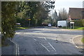
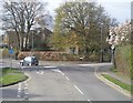
Church Road / Gordon Road, Crowborough
North-west from Chapel Green looking at Church Road / Gordon Road junction
Image: © Geoff Cooper
Taken: 18 Dec 2009
0.19 miles